|
search place name
|
||
Deringaj (Croatia)Deringaj is a town in Croatia. An overview map of the region around Deringaj is displayed below.
regional and 3d topo map of Deringaj, Croatia ::

Deringaj airports ::
The nearest airport is ZAD - Zadar, located 49.6 km south west of Deringaj.
Other airports nearby include SPU - Split (94.3 km south), RJK - Rijeka (143.0 km north west), ZAG - Zagreb (157.3 km north), PUY - Pula (167.6 km north west), Nearby towns ::
Kolundžići (1.4km east) //
Jelače (1.4km north east) //
Surle (1.9km north east) //
Inđići (2.4km north east) //
Sovilji (2.4km north east) //
Trtica (3.2km north east) //
Petrovići (3.3km north east) //
Donja Omsica (3.6km north east) //
Jakšić (3.9km south east) //
Manojlovići (3.9km north east) //
Gračac (4.3km south west) //
Jerkovići (5.1km south) //
Sovilji (4.2km east) //
Ivanići (4.3km north east) //
Grab (5.7km south) //
Radusini (5.9km south) //
Maričići (4.4km east) //
Mijakovič (5.1km south east) //
Grubačevo Polje (4.7km east) //
Novoselci (4.6km east) //
Omsica (5.1km north east) //
Kuburići (5.2km north east) //
Poljice Miljuševo (5.7km north east) //
Javorovići (6.9km south) //
Aleksići (5.1km east) //
Gornja Omsica (5.9km north east) //
Mekote (5.8km south east) //
Dolovi (6.8km north east) //
Drenovci (5.5km east) //
[all distances 'as the bird flies' and approximate] 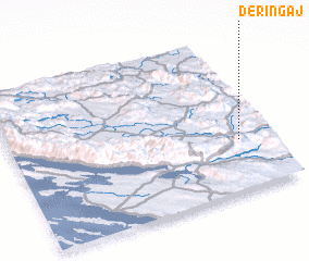
Disclaimer :: Information on this page comes without warranty of any kind |
||
|
Where is Deringaj? Elevation and coordinates ::
Latitude (lat): 44°20'0"N Longitude (lon): 15°53'0"E
Elevation (approx.): 620m (map arrows pan, magnifying glasses zoom) |
||
|
Visiting Deringaj? Hotel/Accommodation ::
Book a hotel in Deringaj Travel Guide ::
Buy a travel guide for Croatia rental cars ::
car rental offers GPS waypoint ::
download a GPX waypoint (PoI) of Deringaj for your GPS receiver
|
||