|
search place name
|
||
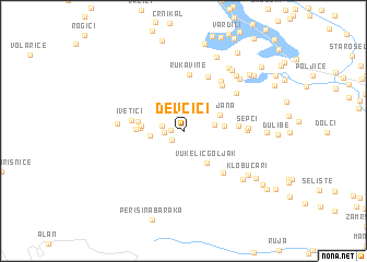
Devčići (Croatia)Devčići is a town in Croatia. An overview map of the region around Devčići is displayed below.
regional and 3d topo map of Devčići, Croatia ::
Devčići airports ::
The nearest airport is RJK - Rijeka, located 60.3 km north west of Devčići.
Other airports nearby include ZAD - Zadar (81.7 km south), PUY - Pula (92.8 km west), ZAG - Zagreb (128.1 km north east), POW - Portoroz (136.9 km north west), Nearby towns ::
Modrići (1.0km west) //
Lemić Dolac (1.2km south west) //
Polje (1.4km west) //
Dujmišići (1.6km west) //
Grezina (2.3km east) //
Panjenovići (2.5km west) //
(( Vukelić Goljak )) (3.7km south east) //
Poljana (3.1km north east) //
Gorsa (3.0km east) //
Kula (3.1km west) //
Krasno Polje (3.2km west) //
Glavaši (3.4km west) //
Anići (3.5km west) //
Ivetići (3.9km west) //
Kuterevo (4.0km east) //
Rukavine (5.8km north) //
Goljak (5.1km south east) //
Vugliši (5.4km north east) //
Gajići (5.8km north) //
Grozdanići (5.8km north east) //
Rončevići (4.5km east) //
Gorići (5.4km north east) //
Šepci (4.7km east) //
Vukelići (4.9km west) //
Trolokve (6.5km south east) //
Ponori (6.8km north east) //
Buk (6.7km north east) //
Klobučari (6.4km south east) //
Banjani (7.2km north east) //
[all distances 'as the bird flies' and approximate]  Places with similar names to Devčići, Croatia ::
Disclaimer :: Information on this page comes without warranty of any kind |
||
|
Where is Devčići? Elevation and coordinates ::
Latitude (lat): 44°49'12"N Longitude (lon): 15°5'28"E
Elevation (approx.): 807m (map arrows pan, magnifying glasses zoom) |
||
|
Visiting Devčići? Hotel/Accommodation ::
Book a hotel in Devčići Travel Guide ::
Buy a travel guide for Croatia rental cars ::
car rental offers GPS waypoint ::
download a GPX waypoint (PoI) of Devčići for your GPS receiver
|
||