|
search place name
|
||
Doci (Croatia)Doci is a town in Croatia. An overview map of the region around Doci is displayed below.
regional and 3d topo map of Doci, Croatia ::

Doci airports ::
The nearest airport is SPU - Split, located 46.1 km west of Doci.
Other airports nearby include OMO - Mostar (94.2 km south east), SJJ - Sarajevo (122.0 km east), ZAD - Zadar (127.5 km west), DBV - Dubrovnik (172.0 km south east), Nearby towns ::
Divljakinja (1.1km east) //
Grepčine (1.5km south west) //
Bitunjski Pod (1.3km north east) //
Ruda Staje (1.9km south east) //
Gornja Korita (2.0km north) //
Marinovići (1.9km north west) //
Njivice (2.6km south) //
Donja Korita (2.0km north west) //
Rosandić (2.1km south east) //
Lacići (2.0km west) //
Tadići (2.4km south east) //
Blaca (2.7km north west) //
Dolac (2.6km south west) //
Topola (2.8km south east) //
Putnik (2.9km south west) //
Kurlani (3.2km south) //
Crljeni (2.8km south west) //
Vlake (2.6km east) //
Mrčela (3.4km south) //
Klima (3.0km north west) //
Roguljići (3.6km south) //
Škivića Dolac (3.9km south) //
Galjske Stanine (3.9km north) //
Projići (3.7km south west) //
Botice (3.8km south) //
Ruda (3.6km south west) //
Rože (4.2km south) //
Pavlinušići (4.1km south) //
Rosandići (3.4km west) //
[all distances 'as the bird flies' and approximate] 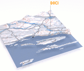 Places with similar names to Doci, Croatia ::
Disclaimer :: Information on this page comes without warranty of any kind |
||
|
Where is Doci? Elevation and coordinates ::
Latitude (lat): 43°41'40"N Longitude (lon): 16°49'38"E
Elevation (approx.): 879m (map arrows pan, magnifying glasses zoom) |
||
|
Visiting Doci? Hotel/Accommodation ::
Book a hotel in Doci Travel Guide ::
Buy a travel guide for Croatia rental cars ::
car rental offers GPS waypoint ::
download a GPX waypoint (PoI) of Doci for your GPS receiver
|
||