|
search place name
|
||
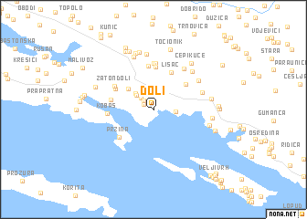
Doli (Croatia)Doli is a town in Croatia. An overview map of the region around Doli is displayed below.
regional and 3d topo map of Doli, Croatia ::
Doli airports ::
The nearest airport is DBV - Dubrovnik, located 47.5 km south east of Doli.
Other airports nearby include OMO - Mostar (53.0 km north), TIV - Tivat (88.4 km south east), SJJ - Sarajevo (121.2 km north), TGD - Podgorica (129.6 km east), Nearby towns ::
Grgovići (1.1km north west) //
Ploča (1.4km north west) //
Ðonta Doli (1.8km north west) //
Smokovina (1.9km east) //
Zabreže (2.3km north west) //
Konjuh (2.6km north west) //
Gornje Zaton (3.4km north west) //
Podimoć (4.2km north east) //
Lisac (4.8km north) //
Visočani (5.3km north) //
Škrabo (4.2km north west) //
Donje Selo (5.3km north) //
Konštari (4.0km west) //
Pržina (4.6km south west) //
Zaton Doli (4.5km north west) //
Gornje Selo (5.7km north) //
Smokovljani (5.7km north) //
Kobaš (4.2km west) //
Kotezi (5.7km north east) //
Dužani (4.8km north east) //
Butijeri (5.4km north east) //
Podgora (5.8km north east) //
Branilovići (6.9km north) //
Smokovljani (6.7km north) //
Kručica (5.4km east) //
Banići (5.3km east) //
Mravnica (5.3km east) //
Zabreže (7.1km north) //
Polje (7.1km north) //
[all distances 'as the bird flies' and approximate]  Places with similar names to Doli, Croatia ::
Disclaimer :: Information on this page comes without warranty of any kind |
||
|
Where is Doli? Elevation and coordinates ::
Latitude (lat): 42°48'25"N Longitude (lon): 17°47'38"E
Elevation (approx.): 5m (map arrows pan, magnifying glasses zoom) |
||
|
Visiting Doli? Hotel/Accommodation ::
Book a hotel in Doli Travel Guide ::
Buy a travel guide for Croatia rental cars ::
car rental offers GPS waypoint ::
download a GPX waypoint (PoI) of Doli for your GPS receiver
|
||