|
search place name
|
||
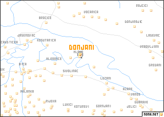
Donjani (Croatia)Donjani is a town in Croatia. An overview map of the region around Donjani is displayed below.
regional and 3d topo map of Donjani, Croatia ::
Donjani airports ::
The nearest airport is ZAG - Zagreb, located 93.7 km north west of Donjani.
Other airports nearby include OSI - Osijek (142.2 km east), MBX - Maribor (173.1 km north west), ZAD - Zadar (182.7 km south west), SJJ - Sarajevo (187.9 km south east), Nearby towns ::
Mlaka (0.6km north west) //
Gornjani (1.9km west) //
(( Jablanac Jasenovački )) (2.8km south east) //
Orahova (4.2km south) //
Sivolinac (4.4km south west) //
Donja Međeđa (5.0km south west) //
Mlinarice (4.5km west) //
Srednja Međeđa (5.7km south west) //
Lužani (6.8km south east) //
Košutarica (6.4km north west) //
Gornja Međeđa (6.4km west) //
Gašnica (8.2km south east) //
Zabrđani (8.9km south east) //
Ravan (8.3km south east) //
Rijeka (8.0km south west) //
Roždanik (9.7km north east) //
Gornji Rajić (9.8km north east) //
Bročice (10.0km north west) //
[all distances 'as the bird flies' and approximate]  Places with similar names to Donjani, Croatia ::
Disclaimer :: Information on this page comes without warranty of any kind |
||
|
Where is Donjani? Elevation and coordinates ::
Latitude (lat): 45°14'3"N Longitude (lon): 17°1'30"E
Elevation (approx.): 89m (map arrows pan, magnifying glasses zoom) |
||
|
Visiting Donjani? Hotel/Accommodation ::
Book a hotel in Donjani Travel Guide ::
Buy a travel guide for Croatia rental cars ::
car rental offers GPS waypoint ::
download a GPX waypoint (PoI) of Donjani for your GPS receiver
|
||