|
search place name
|
||
Fadljevići (Croatia)Fadljevići is a town in Croatia. An overview map of the region around Fadljevići is displayed below.
regional and 3d topo map of Fadljevići, Croatia ::

nearby GPS traces from timatio ::
Fadljevići airports ::
The nearest airport is ZAD - Zadar, located 65.0 km south of Fadljevići.
Other airports nearby include RJK - Rijeka (85.0 km north west), PUY - Pula (115.6 km west), ZAG - Zagreb (129.4 km north east), SPU - Split (148.8 km south east), Nearby towns ::
Ćutići (1.0km south) //
Kasumovići (1.0km east) //
Javorine (1.6km north) //
Milkovići (1.6km south) //
Klenovac (1.4km south east) //
Sitvuci (1.7km south west) //
Milkovići (2.0km north) //
Studenci (2.0km north) //
Markovo Selo (2.3km south) //
Gavrani (2.1km south east) //
Mezinovac (2.6km south west) //
Pećani (2.1km east) //
Jolići (2.2km east) //
Kolari (2.9km south east) //
Karići (2.8km south east) //
Uzelci (3.0km north west) //
Nogonjići (3.6km south) //
Jurkovići (3.3km north east) //
Škodići (3.8km south) //
Malo Polje (4.1km south) //
Kvarte (3.6km south east) //
Tomaševići (3.6km north east) //
Kiljer (3.1km east) //
Radovići (4.3km north) //
Varoš (3.9km south east) //
Lončari (4.1km south west) //
Jurišići (4.5km south) //
Paripovići (4.7km north) //
Lulići (4.7km south) //
[all distances 'as the bird flies' and approximate] 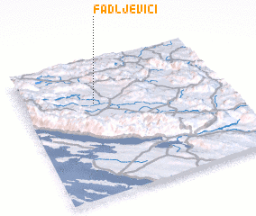 Places with similar names to Fadljevići, Croatia :: Disclaimer :: Information on this page comes without warranty of any kind |
||
|
Where is Fadljevići? Elevation and coordinates ::
Latitude (lat): 44°41'36"N Longitude (lon): 15°21'19"E
Elevation (approx.): 582m (map arrows pan, magnifying glasses zoom) |
||
|
Visiting Fadljevići? Hotel/Accommodation ::
Book a hotel in Fadljevići Travel Guide ::
Buy a travel guide for Croatia rental cars ::
car rental offers GPS waypoint ::
download a GPX waypoint (PoI) of Fadljevići for your GPS receiver
|
||