|
search place name
|
||
Gora (Sisačko-Moslavačka Županija, Croatia)Gora is a town in the Sisačko-Moslavačka Županija region of Croatia. An overview map of the region around Gora is displayed below.
regional and 3d topo map of Gora, Croatia ::

Gora airports ::
The nearest airport is ZAG - Zagreb, located 37.3 km north of Gora.
Other airports nearby include MBX - Maribor (124.3 km north), RJK - Rijeka (129.1 km west), ZAD - Zadar (160.3 km south west), LJU - Ljubliana Ljubljana (161.8 km north west), Nearby towns ::
Strašnik (2.9km south east) //
Graberje (4.0km south west) //
Novo Selište (3.4km north east) //
Glinska Poljana (3.5km west) //
Novo Selo Glinsko (5.5km south) //
Dumače (6.1km north) //
Marinbrod (5.2km south west) //
Križ Hrastovički (4.5km east) //
Nebojan (6.8km north) //
Pecki (5.7km south east) //
Slana (5.7km north west) //
Stari Brod (7.4km north) //
Brnjeuška (7.7km south) //
Lušćani (7.9km south) //
Novi Farkašić (7.9km north west) //
Brest Pokupski (6.6km north east) //
Cepeliš (6.1km east) //
Hađer (7.0km south west) //
Majske Poljane (8.4km south west) //
Gornja Bačuga (7.0km south east) //
Donja Bačuga (8.3km south east) //
Mala Gorica (8.4km north east) //
Prekopa (7.9km south west) //
Stari Farkašić (8.9km north west) //
[all distances 'as the bird flies' and approximate] 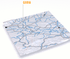 Places with similar names to Gora, Croatia ::
Disclaimer :: Information on this page comes without warranty of any kind |
||
|
Where is Gora? Elevation and coordinates ::
Latitude (lat): 45°25'9"N Longitude (lon): 16°11'32"E
Elevation (approx.): 154m (map arrows pan, magnifying glasses zoom) |
||
|
Visiting Gora? Hotel/Accommodation ::
Book a hotel in Gora Travel Guide ::
Buy a travel guide for Croatia rental cars ::
car rental offers GPS waypoint ::
download a GPX waypoint (PoI) of Gora for your GPS receiver
|
||