|
search place name
|
||
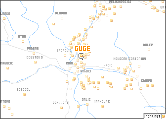
Guge (Croatia)Guge is a town in Croatia. An overview map of the region around Guge is displayed below.
regional and 3d topo map of Guge, Croatia ::
Guge airports ::
The nearest airport is SPU - Split, located 58.3 km south of Guge.
Other airports nearby include ZAD - Zadar (70.7 km west), OMO - Mostar (156.6 km south east), RJK - Rijeka (183.7 km north west), ZAG - Zagreb (187.3 km north), Nearby towns ::
Jelići (0.7km south) //
Borovnice (0.7km north east) //
Anića Glavica (0.7km north west) //
Vrpolje (1.0km north) //
Medakovići (1.0km south) //
Mirkovići (0.9km west) //
Grgići (1.3km north east) //
Kovačić (1.5km south) //
Segetin (1.3km north east) //
Topolje (2.0km south) //
Kninsko Polje (1.7km south west) //
Krvavice (2.1km south west) //
Gambiroža (2.0km north east) //
Kulundžije (2.0km north west) //
Mlinarevići (2.7km south) //
Bjelje (2.4km north west) //
Grubići (2.8km north west) //
Arule (3.1km north) //
Marići (3.4km north) //
Džepine (3.2km north west) //
Kesići (3.4km north) //
Knin (2.9km south west) //
Kovići (3.4km south west) //
Bubonje (3.7km north) //
Torlaci (3.4km north west) //
Prijići (3.8km south) //
Zelembabe (3.6km north west) //
Žagrović (3.1km west) //
Golubić (3.8km north west) //
[all distances 'as the bird flies' and approximate] 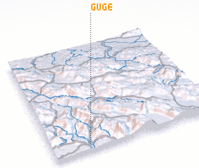 Places with similar names to Guge, Croatia ::
Disclaimer :: Information on this page comes without warranty of any kind |
||
|
Where is Guge? Elevation and coordinates ::
Latitude (lat): 44°3'41"N Longitude (lon): 16°13'36"E
Elevation (approx.): 254m (map arrows pan, magnifying glasses zoom) |
||
|
Visiting Guge? Hotel/Accommodation ::
Book a hotel in Guge Travel Guide ::
Buy a travel guide for Croatia rental cars ::
car rental offers GPS waypoint ::
download a GPX waypoint (PoI) of Guge for your GPS receiver
|
||