|
search place name
|
||
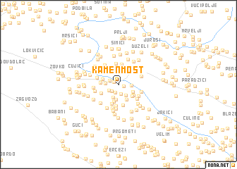
Kamenmost (Croatia)Kamenmost is a town in Croatia. An overview map of the region around Kamenmost is displayed below.
regional and 3d topo map of Kamenmost, Croatia ::
Kamenmost airports ::
The nearest airport is OMO - Mostar, located 55.8 km east of Kamenmost.
Other airports nearby include SPU - Split (72.9 km west), SJJ - Sarajevo (102.5 km north east), DBV - Dubrovnik (130.5 km south east), ZAD - Zadar (166.4 km north west), Nearby towns ::
Perići (0.6km south east) //
Mali Nebriževac (0.7km north west) //
Vujevići (1.3km south) //
Znaori (1.5km south) //
Drum (1.3km south west) //
Veliki Nebriževac (1.2km north west) //
Tolići (1.5km south west) //
Buljubašići (1.5km east) //
Kasali (1.9km south east) //
Jonjići (1.5km west) //
Milasi (2.1km south) //
Lončari (2.3km south) //
Divići (2.4km north) //
Donja Glavina (2.3km north east) //
Milasi (2.0km south east) //
Potočine (2.5km south) //
Zdilari (2.7km north) //
Mracaj (2.0km north west) //
Zmijavci (2.3km south east) //
Buljani (2.8km south) //
Karini (2.1km west) //
Milasi (2.4km south east) //
(( Glavina Srednja )) (2.9km north east) //
Šušnjari (2.4km south west) //
Kukavice (3.2km north) //
Čapini (3.1km south) //
Podbablje (3.3km south) //
Rašići (3.4km north) //
Lončari (3.4km south) //
[all distances 'as the bird flies' and approximate]  Places with similar names to Kamenmost, Croatia ::
Disclaimer :: Information on this page comes without warranty of any kind |
||
|
Where is Kamenmost? Elevation and coordinates ::
Latitude (lat): 43°25'35"N Longitude (lon): 17°11'10"E
Elevation (approx.): 346m (map arrows pan, magnifying glasses zoom) |
||
|
Visiting Kamenmost? Hotel/Accommodation ::
Book a hotel in Kamenmost Travel Guide ::
Buy a travel guide for Croatia rental cars ::
car rental offers GPS waypoint ::
download a GPX waypoint (PoI) of Kamenmost for your GPS receiver
|
||