|
search place name
|
||
Kraj (Croatia)Kraj is a town in Croatia. An overview map of the region around Kraj is displayed below.
regional and 3d topo map of Kraj, Croatia ::

Kraj airports ::
The nearest airport is ZAD - Zadar, located 19.1 km north of Kraj.
Other airports nearby include SPU - Split (85.6 km south east), RJK - Rijeka (156.2 km north west), PUY - Pula (157.8 km north west), PSR - Pescara (194.2 km south west), Nearby towns ::
Ugrinići (1.2km south east) //
Pašman (2.0km north) //
Mrljane (2.2km north west) //
Tkon (2.2km east) //
Mali Pašman (2.8km north west) //
Turanj (3.9km north east) //
Sveti Filip i Jakov (4.2km north east) //
Cimera (4.4km north west) //
Biograd na Moru (5.0km east) //
Neviđane (6.0km north west) //
Krmčina (7.0km north) //
Sikovo (7.2km north east) //
Sikovo (7.8km north) //
Opatijski Torovi (6.1km east) //
Dobropoljana (8.2km north west) //
Pristanišće (9.7km south west) //
[all distances 'as the bird flies' and approximate] 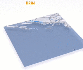 Places with similar names to Kraj, Croatia ::
Disclaimer :: Information on this page comes without warranty of any kind |
||
|
Where is Kraj? Elevation and coordinates ::
Latitude (lat): 43°56'23"N Longitude (lon): 15°23'25"E
Elevation (approx.): -32768m (map arrows pan, magnifying glasses zoom) |
||
|
Visiting Kraj? Hotel/Accommodation ::
Book a hotel in Kraj Travel Guide ::
Buy a travel guide for Croatia rental cars ::
car rental offers GPS waypoint ::
download a GPX waypoint (PoI) of Kraj for your GPS receiver
|
||