|
search place name
|
||
Kulica (Croatia)Kulica is a town in Croatia. An overview map of the region around Kulica is displayed below.
regional and 3d topo map of Kulica, Croatia ::

Kulica airports ::
The nearest airport is ZAD - Zadar, located 49.0 km south of Kulica.
Other airports nearby include RJK - Rijeka (101.0 km north west), PUY - Pula (125.7 km west), SPU - Split (131.6 km south east), ZAG - Zagreb (142.2 km north), Nearby towns ::
Polovine (1.3km east) //
Butkovići (2.5km south) //
Šimunići (2.7km south) //
Brdo (2.2km south east) //
Ostrvica (2.4km north east) //
Bilaj (3.0km south) //
Babulj (2.6km south east) //
Šerići (2.6km south east) //
Basarića Draga (2.5km east) //
Novoselo Bilajsko (3.4km south) //
Vukelići (2.6km west) //
Krpani (2.7km west) //
Vučjak (3.4km north east) //
Rosulje (4.1km south) //
Novoselija (4.1km north) //
Volarice (3.1km east) //
Lipe (3.1km west) //
Adžije (3.2km west) //
Barlete (3.3km east) //
Rujnica (4.8km north) //
Zavođe (3.7km south east) //
Gradsko Selo (4.5km north west) //
Nikšići (5.4km north) //
Radmanovići (3.9km east) //
Stari Budak (5.0km north west) //
Cukovac (5.7km north) //
Šarići (4.9km north west) //
Rašete (4.3km east) //
Urija (5.9km north) //
[all distances 'as the bird flies' and approximate] 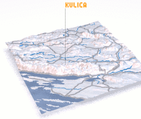 Places with similar names to Kulica, Croatia ::
Disclaimer :: Information on this page comes without warranty of any kind |
||
|
Where is Kulica? Elevation and coordinates ::
Latitude (lat): 44°32'43"N Longitude (lon): 15°25'56"E
Elevation (approx.): 569m (map arrows pan, magnifying glasses zoom) |
||
|
Visiting Kulica? Hotel/Accommodation ::
Book a hotel in Kulica Travel Guide ::
Buy a travel guide for Croatia rental cars ::
car rental offers GPS waypoint ::
download a GPX waypoint (PoI) of Kulica for your GPS receiver
|
||