|
search place name
|
||
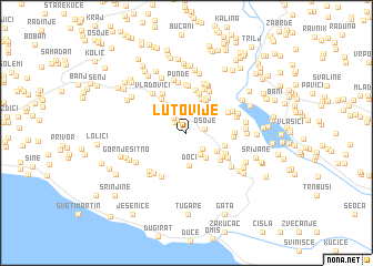
Lutovije (Croatia)Lutovije is a town in Croatia. An overview map of the region around Lutovije is displayed below.
regional and 3d topo map of Lutovije, Croatia ::
Lutovije airports ::
The nearest airport is SPU - Split, located 29.7 km west of Lutovije.
Other airports nearby include OMO - Mostar (99.8 km east), ZAD - Zadar (123.4 km north west), SJJ - Sarajevo (138.0 km east), DBV - Dubrovnik (170.0 km south east), Nearby towns ::
Smajići (1.5km north west) //
Ćosići (1.4km north west) //
Osoje (1.4km east) //
Tukići (1.7km north west) //
Braovići (2.0km south east) //
Bradarići (2.4km north) //
Dešiševići (2.4km south east) //
Trišnjevo (2.5km north east) //
Punde (2.9km north) //
Simunići (2.8km south east) //
Doci (3.3km south) //
Donji Gornjani (2.9km south east) //
Kotlenice (3.4km north west) //
Donji Kraj (3.6km north) //
Videkići (3.6km north east) //
Vrižice (3.4km north east) //
Donji Dolac (3.0km south east) //
Akrap (3.9km north east) //
Vukovići (3.8km north west) //
Strikići (4.1km north) //
Pezelj (3.5km south east) //
Bulati (4.3km north) //
Latkovići (3.7km south east) //
Gornji Gornjani (3.5km south east) //
Perići (4.3km north west) //
Gornja Rošca (3.7km north east) //
Okruglica (3.5km east) //
Vukovići (4.8km north) //
Gornji Kraj (4.5km north) //
[all distances 'as the bird flies' and approximate]  Places with similar names to Lutovije, Croatia :: Disclaimer :: Information on this page comes without warranty of any kind |
||
|
Where is Lutovije? Elevation and coordinates ::
Latitude (lat): 43°32'25"N Longitude (lon): 16°39'54"E
Elevation (approx.): 567m (map arrows pan, magnifying glasses zoom) |
||
|
Visiting Lutovije? Hotel/Accommodation ::
Book a hotel in Lutovije Travel Guide ::
Buy a travel guide for Croatia rental cars ::
car rental offers GPS waypoint ::
download a GPX waypoint (PoI) of Lutovije for your GPS receiver
|
||