|
search place name
|
||
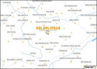
Mala Mlinska (Croatia)Mala Mlinska is a town in Croatia. An overview map of the region around Mala Mlinska is displayed below.
regional and 3d topo map of Mala Mlinska, Croatia ::
Mala Mlinska airports ::
The nearest airport is ZAG - Zagreb, located 69.4 km west of Mala Mlinska.
Other airports nearby include MBX - Maribor (132.6 km north west), OSI - Osijek (146.8 km east), GRZ - Graz (186.9 km north west), ZAD - Zadar (215.6 km south west), Nearby towns ::
Velika Trnovitica (0.7km north) //
Velika Mlinska (2.9km south west) //
Mala Trnovitica (4.0km north) //
Palešnik (4.8km south) //
Veliki Pašijan (4.9km south) //
Mali Pašijan (5.1km south) //
Dražica (5.0km north east) //
Ladislav (4.8km north east) //
Zdenčac (6.8km south) //
Hercegovac (5.0km south east) //
Kostanjevac (5.2km west) //
Nova Ploščica (7.0km north) //
Orlovac (7.8km north) //
Ruškovac (7.0km north west) //
Kovačica Slovinska (8.5km north) //
Velika Trnava (6.2km east) //
Tomašica (8.4km south east) //
Donja Kovačica (8.9km north east) //
Dišnik (9.4km south west) //
Klokočevac Ilovski (8.3km south east) //
[all distances 'as the bird flies' and approximate] 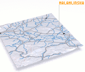 Places with similar names to Mala Mlinska, Croatia :: Disclaimer :: Information on this page comes without warranty of any kind |
||
|
Where is Mala Mlinska? Elevation and coordinates ::
Latitude (lat): 45°40'36"N Longitude (lon): 16°57'16"E
Elevation (approx.): 142m (map arrows pan, magnifying glasses zoom) |
||
|
Visiting Mala Mlinska? Hotel/Accommodation ::
Book a hotel in Mala Mlinska Travel Guide ::
Buy a travel guide for Croatia rental cars ::
car rental offers GPS waypoint ::
download a GPX waypoint (PoI) of Mala Mlinska for your GPS receiver
|
||