|
search place name
|
||
Manjavas (Croatia)Manjavas is a town in Croatia. An overview map of the region around Manjavas is displayed below.
regional and 3d topo map of Manjavas, Croatia ::

Manjavas airports ::
The nearest airport is ZAG - Zagreb, located 30.0 km east of Manjavas.
Other airports nearby include MBX - Maribor (81.1 km north), RJK - Rijeka (105.3 km south west), LJU - Ljubliana Ljubljana (108.6 km north west), GRZ - Graz (139.2 km north), Nearby towns ::
Braslovje (1.3km west) //
Plešivica (2.3km south west) //
Rude (2.3km north west) //
Cerje (2.3km north east) //
Stankovo (3.9km south) //
Velika Rakovica (3.2km north east) //
Beter (3.2km south east) //
Gregurić Breg (4.5km north west) //
Mala Rakovica (4.5km north east) //
Klake (3.9km east) //
Gornji Desinec (5.7km south) //
Vrhovčak (5.7km north) //
Prhoč (5.7km south) //
Veliki Lipovec (4.3km north west) //
Konjšćica (4.3km north east) //
Vranov Dol (4.9km south west) //
Lokošin Dol (6.1km south west) //
Draganje-Selo (6.1km north west) //
Slani Dol (5.4km north west) //
Kladje (5.4km north east) //
Samobor (6.5km north east) //
Mali Lipovec (5.2km west) //
Otruševec (7.4km north) //
Sveti Martin pod Okićem (5.2km east) //
Slapnica (5.5km west) //
Galgovo (5.5km east) //
Molvice (5.5km east) //
Donji Desinec (7.8km south) //
Zdihovo (7.9km south) //
[all distances 'as the bird flies' and approximate] 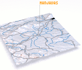 Places with similar names to Manjavas, Croatia :: Disclaimer :: Information on this page comes without warranty of any kind |
||
|
Where is Manjavas? Elevation and coordinates ::
Latitude (lat): 45°45'0"N Longitude (lon): 15°41'0"E
Elevation (approx.): 524m (map arrows pan, magnifying glasses zoom) |
||
|
Visiting Manjavas? Hotel/Accommodation ::
Book a hotel in Manjavas Travel Guide ::
Buy a travel guide for Croatia rental cars ::
car rental offers GPS waypoint ::
download a GPX waypoint (PoI) of Manjavas for your GPS receiver
|
||