|
search place name
|
||
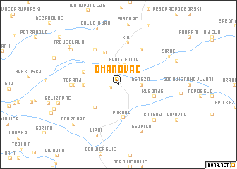
Omanovac (Croatia)Omanovac is a town in Croatia. An overview map of the region around Omanovac is displayed below.
regional and 3d topo map of Omanovac, Croatia ::
Omanovac airports ::
The nearest airport is ZAG - Zagreb, located 91.6 km west of Omanovac.
Other airports nearby include OSI - Osijek (127.2 km east), MBX - Maribor (160.4 km north west), SJJ - Sarajevo (205.6 km south east), ZAD - Zadar (210.9 km south west), Nearby towns ::
Gornja Obrijež (1.1km south west) //
Badljevina (3.2km north) //
Dereza (2.6km east) //
Batinjani Pakrački (4.5km south west) //
Pakrac (5.2km south) //
Gornji Sređani (5.3km north) //
Donja Obrijež (3.9km west) //
Kusonje (4.3km south east) //
Kapetanovo Polje (4.3km north west) //
Donji Sređani (6.1km north west) //
Miljanovac (6.1km north east) //
Kip (6.6km north) //
Toranj (5.0km west) //
Ploštine (5.2km west) //
Kraguj (6.8km south east) //
Šeovica (7.9km south) //
Lipik (8.4km south) //
Sirač (7.1km north east) //
Gornji Uljanik (7.6km north west) //
Dobrovac (7.9km south west) //
Golubinjak (9.2km north) //
Trojeglava (8.0km north west) //
[all distances 'as the bird flies' and approximate] 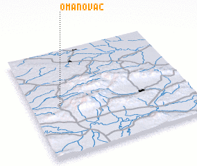 Places with similar names to Omanovac, Croatia :: Disclaimer :: Information on this page comes without warranty of any kind |
||
|
Where is Omanovac? Elevation and coordinates ::
Latitude (lat): 45°29'0"N Longitude (lon): 17°11'0"E
Elevation (approx.): 158m (map arrows pan, magnifying glasses zoom) |
||
|
Visiting Omanovac? Hotel/Accommodation ::
Book a hotel in Omanovac Travel Guide ::
Buy a travel guide for Croatia rental cars ::
car rental offers GPS waypoint ::
download a GPX waypoint (PoI) of Omanovac for your GPS receiver
|
||