|
search place name
|
||
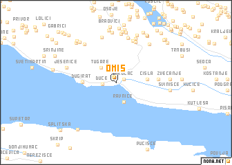
Omiš (Croatia)Omiš is a town in Croatia. An overview map of the region around Omiš is displayed below.
regional and 3d topo map of Omiš, Croatia ::
Omiš airports ::
The nearest airport is SPU - Split, located 33.3 km west of Omiš.
Other airports nearby include OMO - Mostar (95.5 km east), ZAD - Zadar (130.8 km north west), SJJ - Sarajevo (139.1 km east), DBV - Dubrovnik (161.9 km south east), Nearby towns ::
Zakučac (1.1km north east) //
Duće (1.7km west) //
Gata (2.6km north) //
Ravnice (3.3km south) //
Tugare (3.0km north west) //
Čisla (3.7km east) //
Dugi Rat (3.9km west) //
Ostrvica (5.0km east) //
Moljva (7.0km north) //
Zidina (7.0km north) //
Putišić (7.4km north) //
Doci (7.5km north) //
Tomići (7.5km north) //
Latkovići (7.9km north) //
Bašići (7.3km north west) //
Tadinci (7.3km north east) //
Simunići (8.2km north) //
Grad (8.2km north) //
Pezelj (8.3km north) //
Jesenice (6.3km north west) //
Končul (8.1km north) //
Dešiševići (8.5km north) //
Gornji Gornjani (8.6km north) //
Zvečanje (6.3km east) //
Donji Gornjani (8.7km north) //
Svinišće (6.4km east) //
Sinovčići (7.8km north west) //
Lokvina (8.4km north east) //
Dubrava (8.0km north west) //
[all distances 'as the bird flies' and approximate] 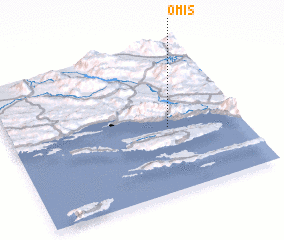 Places with similar names to Omiš, Croatia ::
Disclaimer :: Information on this page comes without warranty of any kind |
||
|
Where is Omiš? Elevation and coordinates ::
Latitude (lat): 43°26'41"N Longitude (lon): 16°41'19"E
Elevation (approx.): 2m (map arrows pan, magnifying glasses zoom) |
||
|
Visiting Omiš? Hotel/Accommodation ::
Book a hotel in Omiš Travel Guide ::
Buy a travel guide for Croatia rental cars ::
car rental offers GPS waypoint ::
download a GPX waypoint (PoI) of Omiš for your GPS receiver
|
||