|
search place name
|
||
Prgometi (Croatia)Prgometi is a town in Croatia. An overview map of the region around Prgometi is displayed below.
regional and 3d topo map of Prgometi, Croatia ::

Prgometi airports ::
The nearest airport is OMO - Mostar, located 53.3 km east of Prgometi.
Other airports nearby include SPU - Split (75.6 km west), SJJ - Sarajevo (105.7 km north east), DBV - Dubrovnik (124.0 km south east), TIV - Tivat (163.3 km south east), Nearby towns ::
Selaci (0.9km south) //
Barići (0.7km west) //
Marinovići (1.3km south east) //
Željci (1.3km west) //
Puljizi (2.1km north east) //
Mrkonjići (1.7km west) //
Ždere (2.3km north east) //
Slivno (2.1km south east) //
Jerkovići (2.8km north) //
Podosoje (2.5km north east) //
Jakovine (2.4km south east) //
Ercezi (3.0km south) //
Gornje Rašćane (3.0km south) //
Garci (3.1km north) //
Lozine (2.5km south east) //
Parlovi (2.4km south east) //
Blaževići (2.5km north west) //
Nuići (3.3km south) //
Dragovići (2.6km north east) //
Ðuđići (3.2km north) //
Ožić Bašići (3.4km south) //
Gornji Selaci (2.7km south west) //
Glibote (2.9km south east) //
Donji Selaci (3.1km south west) //
Prgomet (3.3km south west) //
Radalji (3.3km south east) //
Gudelji (3.8km north) //
Kovačevići (4.1km south) //
Šabići (4.2km north) //
[all distances 'as the bird flies' and approximate] 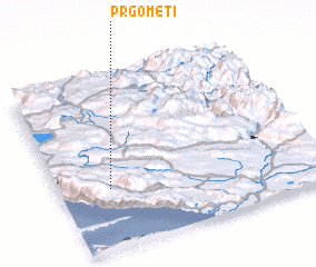
Disclaimer :: Information on this page comes without warranty of any kind |
||
|
Where is Prgometi? Elevation and coordinates ::
Latitude (lat): 43°21'6"N Longitude (lon): 17°11'43"E
Elevation (approx.): 388m (map arrows pan, magnifying glasses zoom) |
||
|
Visiting Prgometi? Hotel/Accommodation ::
Book a hotel in Prgometi Travel Guide ::
Buy a travel guide for Croatia rental cars ::
car rental offers GPS waypoint ::
download a GPX waypoint (PoI) of Prgometi for your GPS receiver
|
||