|
search place name
|
||
Rajčević (Croatia)Rajčević is a town in Croatia. An overview map of the region around Rajčević is displayed below.
regional and 3d topo map of Rajčević, Croatia ::

Rajčević airports ::
The nearest airport is ZAD - Zadar, located 50.2 km south of Rajčević.
Other airports nearby include RJK - Rijeka (92.0 km north west), PUY - Pula (113.4 km west), SPU - Split (139.8 km south east), ZAG - Zagreb (145.9 km north east), Nearby towns ::
(( Pejnovići )) (0.6km north west) //
(( Ljutača )) (1.0km east) //
(( Pejnovići )) (1.4km north) //
Skladište Gavrilović (1.5km south) //
Selište (2.0km north) //
Rukavine (2.7km south) //
Miškulini (2.2km north west) //
Vaganac (2.7km north east) //
Pavičići (2.7km north west) //
Kovačevići (2.2km east) //
Bužim (2.6km north west) //
Trnovac (3.4km south) //
(( Papičić Selo )) (3.1km north west) //
Milkovića Varoš (3.0km north east) //
(( Srdari )) (2.9km north west) //
Donje Selo (3.6km south) //
Gornje Selo (3.5km south) //
Rudelići (3.0km south east) //
Brkljačići (3.9km south) //
Pavelići (3.2km south east) //
Obljajac (4.0km north) //
(( Okrugli Dolac )) (3.2km south west) //
Bogdanić (3.1km east) //
Rasovača (3.2km east) //
Jadovno (3.5km south west) //
Došeni (3.7km north west) //
Rastoka (4.6km north) //
Smiljan (3.6km east) //
Miljača (3.9km north east) //
[all distances 'as the bird flies' and approximate] 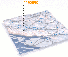 Places with similar names to Rajčević, Croatia ::
// Rajčevac (BA)
Disclaimer :: Information on this page comes without warranty of any kind |
||
|
Where is Rajčević? Elevation and coordinates ::
Latitude (lat): 44°33'25"N Longitude (lon): 15°16'24"E
Elevation (approx.): 561m (map arrows pan, magnifying glasses zoom) |
||
|
Visiting Rajčević? Hotel/Accommodation ::
Book a hotel in Rajčević Travel Guide ::
Buy a travel guide for Croatia rental cars ::
car rental offers GPS waypoint ::
download a GPX waypoint (PoI) of Rajčević for your GPS receiver
|
||