|
search place name
|
||
Sastavak (Croatia)Sastavak is a town in Croatia. An overview map of the region around Sastavak is displayed below.
regional and 3d topo map of Sastavak, Croatia ::

Sastavak airports ::
The nearest airport is ZAG - Zagreb, located 81.5 km north of Sastavak.
Other airports nearby include RJK - Rijeka (91.3 km west), ZAD - Zadar (109.0 km south), PUY - Pula (142.0 km west), MBX - Maribor (158.4 km north), Nearby towns ::
Kosa (1.0km north) //
Zapoljak (1.1km south east) //
Božić Brdo (1.8km north) //
Furjan (1.9km north west) //
Rajkovići (2.6km south west) //
Ćeruvija (2.9km south) //
Božići (3.1km north) //
Gornji Furjan (2.4km west) //
Donji Furjan (2.6km north west) //
Trnovi (3.4km north) //
Trboši (2.8km north east) //
Bogovolja (3.0km north east) //
Radulovići (3.5km south) //
Bijelci (2.6km east) //
Soleši (3.2km south west) //
Blanuše (3.6km north east) //
Mašvina (3.9km south) //
Salopek Selo (3.3km north west) //
Carević Selo (3.1km east) //
Skukani (4.3km north) //
Barić Selo (4.1km north) //
Zrilić (3.6km north east) //
Donji Lipovac (4.7km south) //
Lug Koranski (3.9km south east) //
Gornji Lipovac (4.2km south west) //
Salopek Luke (5.0km north) //
Mikići (4.6km north west) //
Poljani (3.8km west) //
Valentići (4.8km north east) //
[all distances 'as the bird flies' and approximate] 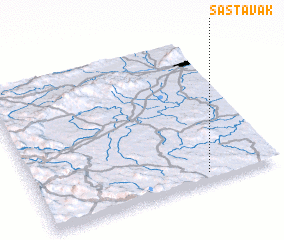 Places with similar names to Sastavak, Croatia ::
Disclaimer :: Information on this page comes without warranty of any kind |
||
|
Where is Sastavak? Elevation and coordinates ::
Latitude (lat): 45°3'18"N Longitude (lon): 15°42'28"E
Elevation (approx.): 290m (map arrows pan, magnifying glasses zoom) |
||
|
Visiting Sastavak? Hotel/Accommodation ::
Book a hotel in Sastavak Travel Guide ::
Buy a travel guide for Croatia rental cars ::
car rental offers GPS waypoint ::
download a GPX waypoint (PoI) of Sastavak for your GPS receiver
|
||