|
search place name
|
||
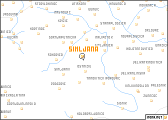
Šimljana (Bjelovarsko-Bilogorska Županija, Croatia)Šimljana is a town in the Bjelovarsko-Bilogorska Županija region of Croatia. An overview map of the region around Šimljana is displayed below.
regional and 3d topo map of Šimljana, Croatia ::
Šimljana airports ::
The nearest airport is ZAG - Zagreb, located 59.1 km west of Šimljana.
Other airports nearby include MBX - Maribor (123.8 km north west), OSI - Osijek (157.1 km east), GRZ - Graz (179.0 km north west), ZAD - Zadar (211.7 km south west), Nearby towns ::
Oštri Zid (2.5km south) //
Krivaja (2.9km north west) //
Berek (4.6km north) //
Donja Petrička (4.4km north west) //
Gornja Garešnica (5.0km south) //
Šimljanica (3.9km north east) //
Šimljanik (4.5km south west) //
Gornja Petrička (5.1km north west) //
Mali Potok (5.1km north east) //
Samarica (4.3km west) //
Babinac Ivanski (6.2km north) //
Trnovitički Popovac (6.0km south east) //
Kostanjevac (6.1km south east) //
Ruškovac (6.0km north east) //
Sredska (7.9km north) //
Podgarić (7.5km south west) //
Križić (8.3km north west) //
Stara Plošćica (8.4km north east) //
Donja Ššnjara (9.6km north west) //
Gornja Šušnjara (9.6km north west) //
[all distances 'as the bird flies' and approximate] 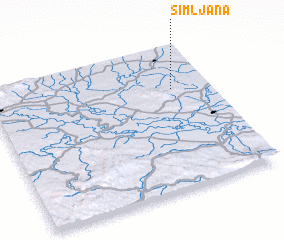 Places with similar names to Šimljana, Croatia ::
Disclaimer :: Information on this page comes without warranty of any kind |
||
|
Where is Šimljana? Elevation and coordinates ::
Latitude (lat): 45°41'51"N Longitude (lon): 16°49'29"E
Elevation (approx.): 132m (map arrows pan, magnifying glasses zoom) |
||
|
Visiting Šimljana? Hotel/Accommodation ::
Book a hotel in Šimljana Travel Guide ::
Buy a travel guide for Croatia rental cars ::
car rental offers GPS waypoint ::
download a GPX waypoint (PoI) of Šimljana for your GPS receiver
|
||