|
search place name
|
||
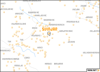
Svinjar (Croatia)Svinjar is a town in Croatia. An overview map of the region around Svinjar is displayed below.
regional and 3d topo map of Svinjar, Croatia ::
Svinjar airports ::
The nearest airport is ZAD - Zadar, located 73.5 km south west of Svinjar.
Other airports nearby include RJK - Rijeka (108.4 km north west), ZAG - Zagreb (118.1 km north), SPU - Split (137.1 km south), PUY - Pula (145.4 km west), Nearby towns ::
Žigići (0.8km west) //
Bjelopolje (0.9km south east) //
Koruge (1.0km north east) //
Drage (1.5km south) //
Breg (1.9km south) //
Tuk Bjelopoljski (1.4km west) //
Pejnovići (1.6km west) //
Delići (2.7km south) //
Podrudinci (2.0km north west) //
Jasikovac (2.6km north west) //
Perišići (2.6km south west) //
Škorići (3.1km south) //
Maklovac (2.7km north east) //
Oravac (3.2km north west) //
Grabušić (3.1km south west) //
Gradina (3.6km north west) //
Šuputi (3.9km north) //
Koraći (3.0km south west) //
Kalemberi (3.5km north west) //
Ponor Korenički (3.6km north east) //
Krst (4.1km north) //
Varićaci (3.3km north west) //
Novo Selo (4.1km north west) //
Vedašić (4.1km south east) //
Šeganovac (4.9km north) //
Pejnovići (3.7km west) //
Titova Korenica (4.9km north west) //
Kalebovac (4.7km north west) //
Vukobratovići (4.3km south west) //
[all distances 'as the bird flies' and approximate] 
Disclaimer :: Information on this page comes without warranty of any kind |
||
|
Where is Svinjar? Elevation and coordinates ::
Latitude (lat): 44°42'22"N Longitude (lon): 15°44'28"E
Elevation (approx.): 670m (map arrows pan, magnifying glasses zoom) |
||
|
Visiting Svinjar? Hotel/Accommodation ::
Book a hotel in Svinjar Travel Guide ::
Buy a travel guide for Croatia rental cars ::
car rental offers GPS waypoint ::
download a GPX waypoint (PoI) of Svinjar for your GPS receiver
|
||