|
search place name
|
||
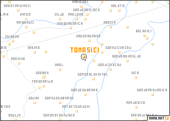
Tomašići (Croatia)Tomašići is a town in Croatia. An overview map of the region around Tomašići is displayed below.
regional and 3d topo map of Tomašići, Croatia ::
Tomašići airports ::
The nearest airport is RJK - Rijeka, located 65.1 km west of Tomašići.
Other airports nearby include ZAG - Zagreb (67.8 km north east), LJU - Ljubliana Ljubljana (117.1 km north west), MBX - Maribor (124.4 km north), PUY - Pula (126.0 km south west), Nearby towns ::
Erdelj (1.3km east) //
Lipa (3.2km north east) //
Generalski Stol (4.2km south) //
Vodena Draga (4.5km north) //
Gradišće (4.5km north east) //
Umol (4.3km south west) //
Donji Zvečaj (4.3km south east) //
Donje Dubrave (7.4km south) //
Gornji Zvečaj (5.5km east) //
Gornje Bukovlje (5.5km east) //
Vukova Gorica (7.5km north) //
Bosiljevo (6.4km west) //
Mračin (8.4km north east) //
[all distances 'as the bird flies' and approximate] 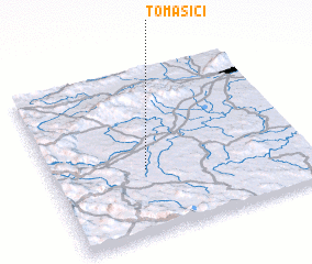 Places with similar names to Tomašići, Croatia ::
Disclaimer :: Information on this page comes without warranty of any kind |
||
|
Where is Tomašići? Elevation and coordinates ::
Latitude (lat): 45°23'0"N Longitude (lon): 15°22'0"E
Elevation (approx.): 147m (map arrows pan, magnifying glasses zoom) |
||
|
Visiting Tomašići? Hotel/Accommodation ::
Book a hotel in Tomašići Travel Guide ::
Buy a travel guide for Croatia rental cars ::
car rental offers GPS waypoint ::
download a GPX waypoint (PoI) of Tomašići for your GPS receiver
|
||