|
search place name
|
||
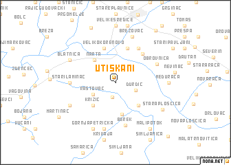
Utiskani (Croatia)Utiskani is a town in Croatia. An overview map of the region around Utiskani is displayed below.
regional and 3d topo map of Utiskani, Croatia ::
Utiskani airports ::
The nearest airport is ZAG - Zagreb, located 58.5 km west of Utiskani.
Other airports nearby include MBX - Maribor (115.5 km north west), OSI - Osijek (159.9 km east), GRZ - Graz (169.5 km north west), ZAD - Zadar (220.9 km south west), Nearby towns ::
Paljevine (1.9km north) //
Ivanska (2.4km south) //
Kolarevo Selo (2.3km north east) //
Ðurđic (2.5km south east) //
Rastovac (3.2km south west) //
Narta (4.3km north west) //
Sredska (4.5km south east) //
Križić (4.5km south west) //
Babinac Ivanski (5.2km south) //
Malo Korenovo (5.7km north) //
Veliko Korenovo (5.7km north) //
Galovac (5.5km north east) //
Novi Pavljani (6.1km north east) //
Berek (6.9km south) //
Obrovnica (5.6km north east) //
Stari Laminac (5.2km west) //
Donja Petrička (7.5km south) //
Brezovac (7.7km north) //
Gornja Šušnjara (6.4km south west) //
Donja Ššnjara (6.4km south west) //
Blatnica (6.4km north west) //
Gornja Petrička (7.9km south) //
Međurača (5.9km east) //
Stara Plošćica (6.8km south east) //
Mali Potok (8.4km south east) //
Ždralovi (9.6km north east) //
Ruškovac (10.5km south east) //
[all distances 'as the bird flies' and approximate]  Places with similar names to Utiskani, Croatia ::
// Utuskun (RU)
Disclaimer :: Information on this page comes without warranty of any kind |
||
|
Where is Utiskani? Elevation and coordinates ::
Latitude (lat): 45°48'0"N Longitude (lon): 16°49'0"E
Elevation (approx.): 135m (map arrows pan, magnifying glasses zoom) |
||
|
Visiting Utiskani? Hotel/Accommodation ::
Book a hotel in Utiskani Travel Guide ::
Buy a travel guide for Croatia rental cars ::
car rental offers GPS waypoint ::
download a GPX waypoint (PoI) of Utiskani for your GPS receiver
|
||