|
search place name
|
||
Valdebek (Croatia)Valdebek is a town in Croatia. An overview map of the region around Valdebek is displayed below.
regional and 3d topo map of Valdebek, Croatia ::

Valdebek airports ::
The nearest airport is PUY - Pula, located 5.9 km north east of Valdebek.
Other airports nearby include RJK - Rijeka (68.1 km north east), POW - Portoroz (72.0 km north), TRS - Ronchi De Legionari Ronchi Dei Legionari (112.9 km north), RMI - Rimini (136.7 km south west), Nearby towns ::
Vintijan (1.5km south west) //
Vinkuran (2.1km south west) //
Šikići (2.1km north east) //
Škatari (2.5km north east) //
Banjole (3.1km south) //
Katarova Stancija (3.2km north east) //
Pula (2.8km north west) //
Pomer (3.5km south east) //
Veruda (3.4km west) //
Jadreški (3.7km north east) //
Premantura (6.3km south east) //
Medulin (5.7km south east) //
Šišan (5.2km east) //
Loborika (7.4km north) //
Fižela (5.8km west) //
Štinjan (6.7km north west) //
Fondole (8.0km north) //
Galižana (8.9km north) //
Muntić (9.9km north east) //
Fažana (10.1km north west) //
[all distances 'as the bird flies' and approximate] 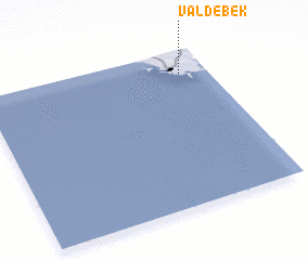 Places with similar names to Valdebek, Croatia ::
// Veldbæk (DK)
Disclaimer :: Information on this page comes without warranty of any kind |
||
|
Where is Valdebek? Elevation and coordinates ::
Latitude (lat): 44°51'8"N Longitude (lon): 13°52'34"E
Elevation (approx.): 30m (map arrows pan, magnifying glasses zoom) |
||
|
Visiting Valdebek? Hotel/Accommodation ::
Book a hotel in Valdebek Travel Guide ::
Buy a travel guide for Croatia rental cars ::
car rental offers GPS waypoint ::
download a GPX waypoint (PoI) of Valdebek for your GPS receiver
|
||