|
search place name
|
||
Zasadbreg (Croatia)Zasadbreg is a town in Croatia. An overview map of the region around Zasadbreg is displayed below.
regional and 3d topo map of Zasadbreg, Croatia ::

Zasadbreg airports ::
The nearest airport is MBX - Maribor, located 55.6 km west of Zasadbreg.
Other airports nearby include ZAG - Zagreb (83.1 km south), GRZ - Graz (95.3 km north west), LJU - Ljubliana Ljubljana (152.4 km west), VIE - Vienna Schwechat (184.8 km north), Nearby towns ::
Donji Zebanec (1.8km north west) //
Zebanec-Selo (2.6km north) //
Žiškovec (1.9km east) //
Pleškovec (2.0km west) //
Strukovec (2.9km north east) //
Merhatovec (2.6km north west) //
Lopatinec (2.9km south west) //
Gornji Zebanec (3.6km north) //
Mačkovec (3.6km south east) //
Brezje (4.0km south west) //
Krištanovec (3.4km east) //
Okrugli Vrh (3.7km south west) //
Selnica (4.9km north) //
Šenkovec (4.9km south) //
Novo Selo Rok (3.8km south east) //
Praporčan (3.6km north west) //
Vratišinec (4.7km north east) //
Slakovec (5.7km south west) //
Gornji Mihaljevec (4.6km south west) //
Mihovljan (5.7km south east) //
Gornji Kraljevec (5.0km east) //
Donji Koncovčak (6.3km north west) //
Mursko Središće (6.8km north) //
Hlapičina (7.7km north) //
Dunjkovec (7.4km south) //
Čakovec (7.7km south) //
Gornji Koncovčak (7.0km north west) //
Nedelišće (8.6km south) //
Peklenica (7.0km north east) //
[all distances 'as the bird flies' and approximate] 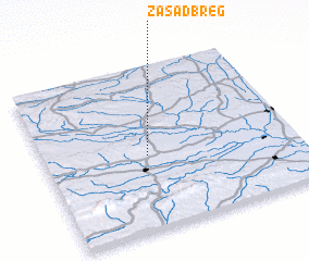 Places with similar names to Zasadbreg, Croatia :: Disclaimer :: Information on this page comes without warranty of any kind |
||
|
Where is Zasadbreg? Elevation and coordinates ::
Latitude (lat): 46°27'7"N Longitude (lon): 16°24'33"E
Elevation (approx.): 252m (map arrows pan, magnifying glasses zoom) |
||
|
Visiting Zasadbreg? Hotel/Accommodation ::
Book a hotel in Zasadbreg Travel Guide ::
Buy a travel guide for Croatia rental cars ::
car rental offers GPS waypoint ::
download a GPX waypoint (PoI) of Zasadbreg for your GPS receiver
|
||