|
search place name
|
||
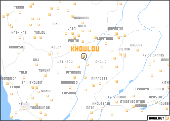
Khoulou (Cyprus)Khoulou is a town in Cyprus. An overview map of the region around Khoulou is displayed below.
regional and 3d topo map of Khoulou, Cyprus ::
Khoulou airports ::
The nearest airport is PFO - Paphos Pafos Intl, located 18.1 km south of Khoulou.
Other airports nearby include AKT - Akrotiri (50.5 km south east), LCA - Larnaca (97.9 km east), Nearby towns ::
Lemona (1.0km south) //
Kourtaka (1.8km south west) //
Kato Panayia (3.7km south) //
Phalia (3.3km south east) //
Psathi (3.8km north west) //
Ayios Dhimitrianos (4.2km north) //
Pitargou (4.2km south west) //
Letimbou (3.7km west) //
Kannaviou (5.4km north) //
Dhrinia (5.4km north) //
Milia (5.7km north) //
Eledhiou (5.8km south) //
Lapithiou (5.3km north east) //
Amargeti (5.7km south east) //
Polemi (5.3km west) //
Statos (5.5km north east) //
Axylou (6.5km south) //
Ayios Photios (5.3km east) //
Phiti (6.5km north) //
Kritou Marottou (6.5km north) //
Lasa (6.4km north) //
Kallepia (5.7km south west) //
Moronero (6.6km south west) //
Pendalia (5.9km east) //
Dhrymou (6.9km north west) //
Statos and Ayios Photios (6.6km east) //
Stroumbi (6.6km west) //
Ayia Marina (7.3km south east) //
Anadhiou (8.3km north) //
[all distances 'as the bird flies' and approximate] 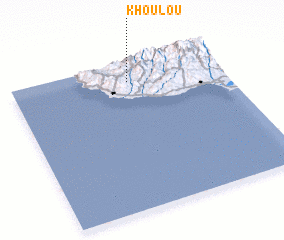 Places with similar names to Khoulou, Cyprus ::
Disclaimer :: Information on this page comes without warranty of any kind |
||
|
Where is Khoulou? Elevation and coordinates ::
Latitude (lat): 34°52'15"N Longitude (lon): 32°33'15"E
Elevation (approx.): 312m (map arrows pan, magnifying glasses zoom) |
||
|
Visiting Khoulou? Hotel/Accommodation ::
Book a hotel in Khoulou Travel Guide ::
Buy a travel guide for Cyprus rental cars ::
car rental offers GPS waypoint ::
download a GPX waypoint (PoI) of Khoulou for your GPS receiver
|
||