|
search place name
|
||
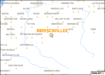
Abreschviller (Lorraine, France)Abreschviller is a town in the Lorraine region of France. An overview map of the region around Abreschviller is displayed below.
regional and 3d topo map of Abreschviller, France ::
Abreschviller airports ::
The nearest airport is SXB - Strassbourg Entzheim, located 40.4 km east of Abreschviller.
Other airports nearby include CMR - Colmar Houssen (61.3 km south), ENC - Nancy Essey (64.4 km west), SCN - Saarbruecken Saarbrucken (64.6 km north), ETZ - Metz Nancy Lorraine (73.4 km north west), Nearby towns ::
Voyer (2.2km north west) //
Vasperviller (2.4km west) //
Saint-Quirin (3.1km south west) //
Hartzviller (3.9km north) //
Biberkirch (3.9km north) //
Trois-Fontaines (3.9km north) //
Walscheid (4.1km north east) //
Plaine-de-Walsch (5.7km north) //
Vallerysthal (6.1km north east) //
Métairies-Saint-Quirin (4.9km west) //
Brouderdorff (7.4km north) //
Schneckenbusch (7.5km north) //
Nitting (6.1km north west) //
Harreberg (6.1km north east) //
Hesse (8.3km north west) //
[all distances 'as the bird flies' and approximate] 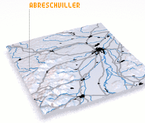 Places with similar names to Abreschviller, France :: Disclaimer :: Information on this page comes without warranty of any kind |
||
|
Where is Abreschviller? Elevation and coordinates ::
Latitude (lat): 48°38'0"N Longitude (lon): 7°6'0"E
Elevation (approx.): 291m (map arrows pan, magnifying glasses zoom) |
||
|
Visiting Abreschviller? Hotel/Accommodation ::
Book a hotel in Abreschviller Travel Guide ::
Buy a travel guide for France rental cars ::
car rental offers GPS waypoint ::
download a GPX waypoint (PoI) of Abreschviller for your GPS receiver
|
||