|
search place name
|
||
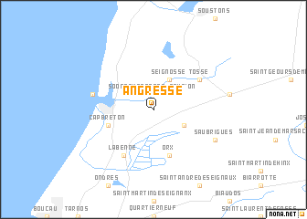
Angresse (Aquitaine, France)Angresse is a town in the Aquitaine region of France. An overview map of the region around Angresse is displayed below.
regional and 3d topo map of Angresse, France ::
Angresse airports ::
The nearest airport is BIQ - Biarritz-bayonne Anglet, located 23.1 km south west of Angresse.
Other airports nearby include EAS - San Sebastian (46.3 km south west), PUF - Pau Pyrenees (83.6 km east), PNA - Pamplona (100.1 km south), XAC - Arcachon La Teste De Buch (107.4 km north), Nearby towns ::
Soorts-Hossegor (2.3km north west) //
Seignosse (3.9km north) //
Saubion (3.3km north east) //
Bénesse-Maremne (3.3km south east) //
Orx (5.7km south) //
Capbreton (4.4km south west) //
Tosse (5.5km north east) //
Labenne (6.2km south west) //
Hossegor (5.7km west) //
Saubrigues (6.5km south east) //
[all distances 'as the bird flies' and approximate] 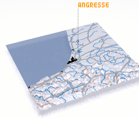 Places with similar names to Angresse, France ::
// Anne Acres (US)
// Angóris (IT)
// Angorez (PT)
// Angoares (ES)
// Angueiros (ES)
// Ankiriza (MG)
// Angres (FR)
// Ahnagh Cross (IE)
// Áno Keraséa (GR)
Disclaimer :: Information on this page comes without warranty of any kind |
||
|
Where is Angresse? Elevation and coordinates ::
Latitude (lat): 43°39'0"N Longitude (lon): 1°23'0"W
Elevation (approx.): 13m (map arrows pan, magnifying glasses zoom) |
||
|
Visiting Angresse? Hotel/Accommodation ::
Book a hotel in Angresse Travel Guide ::
Buy a travel guide for France rental cars ::
car rental offers GPS waypoint ::
download a GPX waypoint (PoI) of Angresse for your GPS receiver
|
||