|
search place name
|
||
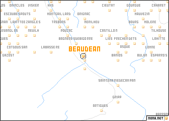
Beaudéan (Midi-Pyrénées, France)Beaudéan is a town in the Midi-Pyrénées region of France. An overview map of the region around Beaudéan is displayed below.
regional and 3d topo map of Beaudéan, France ::
Beaudéan airports ::
The nearest airport is LDE - Tarbes Lourdes, located 21.4 km north west of Beaudéan.
Other airports nearby include PUF - Pau Pyrenees (61.2 km north west), LRH - La Rochelle Lherm (100.3 km north east), TLS - Toulouse Blagnac (117.5 km north east), LEU - Seo De Urgel (127.8 km south east), Nearby towns ::
Asté (0.0km north) //
Campan (1.9km south) //
Gerde (1.9km north) //
Bagnères-de-Bigorre (3.9km north) //
Argelès (6.2km north east) //
Uzer (6.2km north east) //
Pouzac (6.2km north west) //
Lies (5.5km north east) //
Banios (5.4km east) //
Hauban (7.4km north) //
Marsas (5.7km east) //
Mérilheu (7.5km north) //
Labassère (5.7km west) //
Bettes (6.9km north east) //
Castillon (6.9km north east) //
Esconnets (6.6km north east) //
Ordizan (7.9km north) //
Sainte-Marie-de-Campan (7.8km south east) //
Trébons (8.5km north west) //
[all distances 'as the bird flies' and approximate]  Places with similar names to Beaudéan, France ::
Disclaimer :: Information on this page comes without warranty of any kind |
||
|
Where is Beaudéan? Elevation and coordinates ::
Latitude (lat): 43°2'0"N Longitude (lon): 0°10'0"W
Elevation (approx.): 612m (map arrows pan, magnifying glasses zoom) |
||
|
Visiting Beaudéan? Hotel/Accommodation ::
Book a hotel in Beaudéan Travel Guide ::
Buy a travel guide for France rental cars ::
car rental offers GPS waypoint ::
download a GPX waypoint (PoI) of Beaudéan for your GPS receiver
|
||