|
search place name
|
||
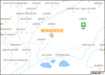
Beauvoisin (Languedoc-Roussillon, France)Beauvoisin is a town in the Languedoc-Roussillon region of France. An overview map of the region around Beauvoisin is displayed below.
regional and 3d topo map of Beauvoisin, France ::
Beauvoisin airports ::
The nearest airport is FNI - Nimes Garons, located 9.2 km north east of Beauvoisin.
Other airports nearby include MPL - Montpellier Mediterranee (32.5 km south west), AVN - Avignon Caumont (51.6 km north east), MRS - Marseille Provence (78.9 km south east), QXB - Aix-les-milles Aix Les Milles (88.0 km east), Nearby towns ::
Aubord (3.7km north) //
Générac (3.3km north east) //
Vauvert (3.3km south west) //
Uchaud (5.5km north west) //
Bernis (6.2km north west) //
Milhaud (7.5km north) //
Vestric-et-Candiac (5.7km west) //
Gallician (7.5km south) //
Franquevaux (7.9km south) //
[all distances 'as the bird flies' and approximate]  Places with similar names to Beauvoisin, France ::
// Bevazzana (IT)
// Bāgh-e Sīneh (IR)
// Bèfasin (BF)
// Bāgh Husain (IN)
// Beuvezin (FR)
// Beauvoisin (FR)
// Boffzen (DE)
// Bovassen (SE)
// Boghiceni (MD)
// Beauvoisin (FR)
Disclaimer :: Information on this page comes without warranty of any kind |
||
|
Where is Beauvoisin? Elevation and coordinates ::
Latitude (lat): 43°43'0"N Longitude (lon): 4°19'0"E
Elevation (approx.): 77m (map arrows pan, magnifying glasses zoom) |
||
|
Visiting Beauvoisin? Hotel/Accommodation ::
Book a hotel in Beauvoisin Travel Guide ::
Buy a travel guide for France rental cars ::
car rental offers GPS waypoint ::
download a GPX waypoint (PoI) of Beauvoisin for your GPS receiver
|
||