|
search place name
|
||
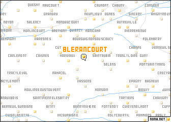
Blérancourt (Picardie, France)Blérancourt is a town in the Picardie region of France. An overview map of the region around Blérancourt is displayed below.
regional and 3d topo map of Blérancourt, France ::
Blérancourt airports ::
The nearest airport is CSF - Creil, located 54.4 km south west of Blérancourt.
Other airports nearby include RHE - Reims Champagne (69.2 km east), CDG - Paris Charles De Gaulle (71.0 km south west), BVA - Beauvais Tille (75.5 km west), LBG - Paris Le Bourget (79.8 km south west), Nearby towns ::
Besmé (2.2km north east) //
Blérancourdelle (2.2km south west) //
Marivaux (2.4km west) //
Lombray (2.4km west) //
Saint-Aubin (2.4km east) //
Bourguignon-sous-Coucy (3.9km north) //
Audignicourt (3.9km south) //
Vassens (5.6km south) //
Cuts (4.1km north west) //
Saint-Paul-aux-Bois (4.1km north east) //
Quierzy (5.7km north) //
Manicamp (5.7km north) //
Selens (4.1km south east) //
Nampcel (5.2km south west) //
Brétigny (6.6km north west) //
Mondescourt (7.8km north) //
Appilly (7.8km north) //
Autrêches (7.8km south) //
Morsain (7.8km south) //
Baboeuf (8.8km north west) //
Bichancourt (8.8km north east) //
[all distances 'as the bird flies' and approximate] 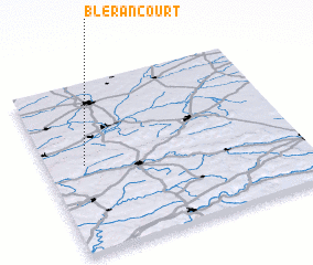 Places with similar names to Blérancourt, France :: Disclaimer :: Information on this page comes without warranty of any kind |
||
|
Where is Blérancourt? Elevation and coordinates ::
Latitude (lat): 49°31'0"N Longitude (lon): 3°9'0"E
Elevation (approx.): 68m (map arrows pan, magnifying glasses zoom) |
||
|
Visiting Blérancourt? Hotel/Accommodation ::
Book a hotel in Blérancourt Travel Guide ::
Buy a travel guide for France rental cars ::
car rental offers GPS waypoint ::
download a GPX waypoint (PoI) of Blérancourt for your GPS receiver
|
||