|
search place name
|
||
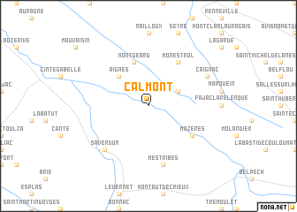
Calmont (Midi-Pyrénées, France)Calmont is a town in the Midi-Pyrénées region of France. An overview map of the region around Calmont is displayed below.
regional and 3d topo map of Calmont, France ::
Calmont airports ::
The nearest airport is LRH - La Rochelle Lherm, located 35.2 km north west of Calmont.
Other airports nearby include TLS - Toulouse Blagnac (44.2 km north west), CCF - Carcassonne Salvaza (55.2 km east), DCM - Castres Mazamet (61.2 km north east), LBI - Albi Le Sequestre (80.1 km north east), Nearby towns ::
 Places with similar names to Calmont, France ::
// Calamintao (PH)
// Calmante (PH)
// Coalmont (US)
// Klement (AT)
// Coalmont (US)
// Claymont (US)
// Coalmont (US)
// Collimento (IT)
// Klementów (PL)
// Klimontów (PL)
Disclaimer :: Information on this page comes without warranty of any kind |
||
|
Where is Calmont? Elevation and coordinates ::
Latitude (lat): 43°17'0"N Longitude (lon): 1°38'0"E
Elevation (approx.): 220m (map arrows pan, magnifying glasses zoom) |
||
|
Visiting Calmont? Hotel/Accommodation ::
Book a hotel in Calmont Travel Guide ::
Buy a travel guide for France rental cars ::
car rental offers GPS waypoint ::
download a GPX waypoint (PoI) of Calmont for your GPS receiver
|
||