|
search place name
|
||
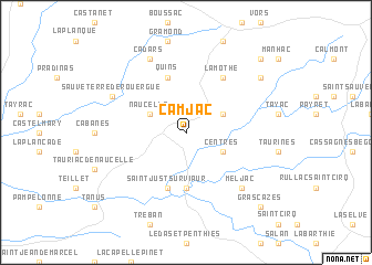
Camjac (Midi-Pyrénées, France)Camjac is a town in the Midi-Pyrénées region of France. An overview map of the region around Camjac is displayed below.
regional and 3d topo map of Camjac, France ::
Camjac airports ::
The nearest airport is RDZ - Rodez Marcillac, located 26.2 km north of Camjac.
Other airports nearby include LBI - Albi Le Sequestre (37.0 km south west), DCM - Castres Mazamet (70.1 km south), AUR - Aurillac (78.7 km north), MEN - Mende Brenoux (98.3 km east), Nearby towns ::
Naucelle (3.2km north west) //
Centrès (3.2km south east) //
Frons (3.2km north east) //
Castelpers (5.6km south) //
Quins (5.7km north) //
Saint-Just-sur-Viaur (5.7km south) //
La Mothe (6.2km north east) //
Meljac (6.8km south east) //
Sauveterre-de-Rouergue (6.5km north west) //
Couliche (7.9km north) //
Cadars (7.9km north) //
Camboulazet (7.7km north east) //
Grascazes (9.1km south east) //
La Combe (9.1km north east) //
[all distances 'as the bird flies' and approximate] 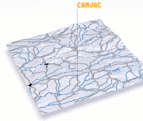 Places with similar names to Camjac, France ::
Disclaimer :: Information on this page comes without warranty of any kind |
||
|
Where is Camjac? Elevation and coordinates ::
Latitude (lat): 44°11'0"N Longitude (lon): 2°23'0"E
Elevation (approx.): 508m (map arrows pan, magnifying glasses zoom) |
||
|
Visiting Camjac? Hotel/Accommodation ::
Book a hotel in Camjac Travel Guide ::
Buy a travel guide for France rental cars ::
car rental offers GPS waypoint ::
download a GPX waypoint (PoI) of Camjac for your GPS receiver
|
||