|
search place name
|
||
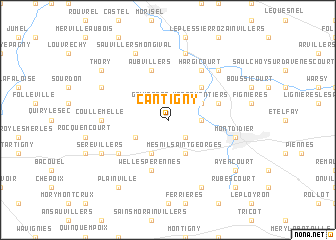
Cantigny (Picardie, France)Cantigny is a town in the Picardie region of France. An overview map of the region around Cantigny is displayed below.
regional and 3d topo map of Cantigny, France ::
Cantigny airports ::
The nearest airport is BVA - Beauvais Tille, located 36.6 km south west of Cantigny.
Other airports nearby include CSF - Creil (46.0 km south), POX - Pontoise Cormeilles En Vexin (71.6 km south west), CDG - Paris Charles De Gaulle (72.8 km south), LBG - Paris Le Bourget (77.7 km south), Nearby towns ::
Malpart (1.9km north) //
Grivesnes (2.2km north west) //
Fontaine-sous-Montdidier (2.2km south east) //
Courtemanche (2.4km east) //
Maresmontiers (3.0km north east) //
Villers-Tournelle (3.0km south west) //
Le Cardonnois (3.9km south) //
Mesnil-Saint-Georges (3.9km south) //
Bouillancourt-la-Bataille (4.4km north east) //
Gratibus (4.0km north east) //
Welles-Pérennes (5.7km south) //
Aubvillers (5.7km north) //
Hargicourt (6.1km north east) //
Broyes (5.2km south west) //
Coullemelle (4.8km west) //
Braches (7.5km north) //
Montdidier (5.1km east) //
Contoire (6.6km north east) //
Pierrepont-sur-Avre (6.6km north east) //
Sauvillers-Mongival (7.8km north) //
Royaucourt (7.8km south) //
Dompierre (7.8km south) //
Ainval-Septoutre (6.1km north west) //
Sérévillers (6.1km south west) //
Ayencourt (7.3km south east) //
Thory (7.3km north west) //
Plainville (8.2km south west) //
Domfront (8.8km south east) //
Rubescourt (8.8km south east) //
[all distances 'as the bird flies' and approximate]  Places with similar names to Cantigny, France ::
// Canaducan (PH)
// Candaigan (PH)
// Guindagan (PH)
// Guintiguian (PH)
// Guintocan (PH)
// Guano de Cana (CU)
// Gündoğan (TR)
// Gündoğan (TR)
// Gündoğan (TR)
// Gündoğan (TR)
Disclaimer :: Information on this page comes without warranty of any kind |
||
|
Where is Cantigny? Elevation and coordinates ::
Latitude (lat): 49°40'0"N Longitude (lon): 2°30'0"E
Elevation (approx.): 104m (map arrows pan, magnifying glasses zoom) |
||
|
Visiting Cantigny? Hotel/Accommodation ::
Book a hotel in Cantigny Travel Guide ::
Buy a travel guide for France rental cars ::
car rental offers GPS waypoint ::
download a GPX waypoint (PoI) of Cantigny for your GPS receiver
|
||