|
search place name
|
||
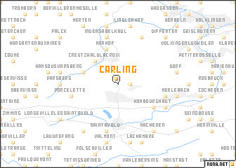
Carling (Lorraine, France)Carling is a town in the Lorraine region of France. An overview map of the region around Carling is displayed below.
regional and 3d topo map of Carling, France ::
Carling airports ::
The nearest airport is SCN - Saarbruecken Saarbrucken, located 29.1 km east of Carling.
Other airports nearby include ETZ - Metz Nancy Lorraine (39.7 km south west), MZM - Metz Frescaty (44.0 km west), LUX - Luxemburg Luxembourg (62.9 km north west), ENC - Nancy Essey (63.7 km south west), Nearby towns ::
LʼHôpital (1.2km east) //
Lauterbach (2.2km north east) //
Creutzwald-la-Croix (4.4km north west) //
Diesen (4.1km north west) //
Marhof (5.7km north) //
Hombourg-Haut (5.2km south east) //
In der Sabelkaul (7.5km north) //
Freyming (5.2km east) //
Saint-Avold (7.5km south) //
Porcelette (5.2km west) //
Friedrichweiler (7.8km north) //
Hombourg-Bas (6.1km south east) //
Dourdʼhal (8.3km south west) //
Macheren (8.3km south east) //
Differten (8.9km north east) //
[all distances 'as the bird flies' and approximate]  Places with similar names to Carling, France ::
Disclaimer :: Information on this page comes without warranty of any kind |
||
|
Where is Carling? Elevation and coordinates ::
Latitude (lat): 49°10'0"N Longitude (lon): 6°43'0"E
Elevation (approx.): 239m (map arrows pan, magnifying glasses zoom) |
||
|
Visiting Carling? Hotel/Accommodation ::
Book a hotel in Carling Travel Guide ::
Buy a travel guide for France rental cars ::
car rental offers GPS waypoint ::
download a GPX waypoint (PoI) of Carling for your GPS receiver
|
||