|
search place name
|
||
Chamelard (Bourgogne, France)Chamelard is a town in the Bourgogne region of France. An overview map of the region around Chamelard is displayed below.
regional and 3d topo map of Chamelard, France ::

Chamelard airports ::
The nearest airport is AUF - Auxerre Branches, located 43.2 km west of Chamelard.
Other airports nearby include QYR - Troyes Barberey (45.2 km north), DIJ - Dijon Longvic (105.4 km south east), NVS - Nevers Fourchambault (124.5 km south west), XCD - Chalon Champforgeuil (133.9 km south east), Nearby towns ::
Mélisey (0.0km north) //
Les Scies (2.5km east) //
Chaserey (3.7km north) //
Chaserey-Bas (3.7km north) //
Chaserey-Haut (3.9km north) //
Molosmes (3.9km south) //
Saint-Martin-sur-Armançon (5.6km south) //
Prusy (5.7km north) //
Thorey (4.2km south east) //
Coussegrey (5.3km north west) //
Vaulichères (5.3km south west) //
Commissey (7.4km south) //
Le Grand Virey (5.0km west) //
Le Châtelier (7.5km north) //
Trichey (5.3km east) //
Chesley (6.7km north east) //
Étourvy (6.2km north east) //
Baon (8.9km south east) //
Le Petit Béru (8.9km south west) //
[all distances 'as the bird flies' and approximate] 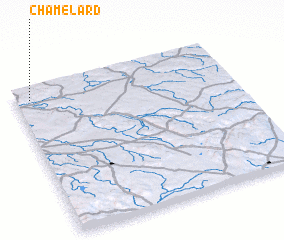 Places with similar names to Chamelard, France ::
// Chamblard (FR)
Disclaimer :: Information on this page comes without warranty of any kind |
||
|
Where is Chamelard? Elevation and coordinates ::
Latitude (lat): 47°55'0"N Longitude (lon): 4°4'0"E
Elevation (approx.): 226m (map arrows pan, magnifying glasses zoom) |
||
|
Visiting Chamelard? Hotel/Accommodation ::
Book a hotel in Chamelard Travel Guide ::
Buy a travel guide for France rental cars ::
car rental offers GPS waypoint ::
download a GPX waypoint (PoI) of Chamelard for your GPS receiver
|
||