|
search place name
|
||
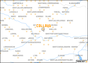
Collaud (Rhône-Alpes, France)Collaud is a town in the Rhône-Alpes region of France. An overview map of the region around Collaud is displayed below.
regional and 3d topo map of Collaud, France ::
Collaud airports ::
The nearest airport is VAF - Valence Chabeuil, located 29.0 km east of Collaud.
Other airports nearby include OBS - Aubenas-vals-lanas Ardeche Meridionale (39.1 km south west), LPY - Le Puy Loudes (72.1 km west), GNB - Grenoble Saint Geoirs (80.0 km north east), EBU - St.-etienne Boutheon (80.8 km north), Nearby towns ::
Saint-Michel-de-Chabrillanoux (1.3km west) //
La Valette (1.9km north) //
Serre (1.9km north) //
Mont (2.3km north east) //
Riailles (2.6km east) //
Conjols (3.7km south) //
Mastenas (3.9km south) //
Roumezoux (3.2km north east) //
Geys (3.2km north west) //
Aulraule (3.2km south west) //
Dunières-sur-Eyrieux (4.5km south east) //
Saint-Sauveur-de-Montagut (4.5km south west) //
Giffon (3.9km west) //
Les Ollières-sur-Eyrieux (5.6km south) //
Silhac (5.7km north) //
Saint-Vincent-de-Durfort (5.7km south) //
Uzanoux (5.7km north) //
Chalencon (5.7km north) //
Saint-Fortunat-sur-Eyrieux (4.4km south east) //
Vernoux-en-Vivarais (6.1km north east) //
Saint-Julien-le-Roux (5.4km north east) //
Jaries (5.4km south west) //
Gluiras (5.3km west) //
Moulancher (5.3km west) //
Bosveuil (5.6km east) //
Saint-Étienne-de-Serres (6.8km south west) //
Châteauneuf-de-Vernoux (7.9km north) //
Saint-Jean-Chambre (7.9km north) //
Les Collanges (7.9km north) //
[all distances 'as the bird flies' and approximate] 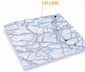 Places with similar names to Collaud, France ::
Disclaimer :: Information on this page comes without warranty of any kind |
||
|
Where is Collaud? Elevation and coordinates ::
Latitude (lat): 44°51'0"N Longitude (lon): 4°37'0"E
Elevation (approx.): 554m (map arrows pan, magnifying glasses zoom) |
||
|
Visiting Collaud? Hotel/Accommodation ::
Book a hotel in Collaud Travel Guide ::
Buy a travel guide for France rental cars ::
car rental offers GPS waypoint ::
download a GPX waypoint (PoI) of Collaud for your GPS receiver
|
||