|
search place name
|
||
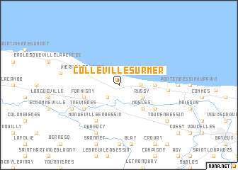
Colleville-sur-Mer (Basse-Normandie, France)Colleville-sur-Mer is a town in the Basse-Normandie region of France. An overview map of the region around Colleville-sur-Mer is displayed below.
regional and 3d topo map of Colleville-sur-Mer, France ::
Colleville-sur-Mer airports ::
The nearest airport is CFR - Caen Carpiquet, located 35.1 km south east of Colleville-sur-Mer.
Other airports nearby include CER - Cherbourg Maupertus (56.0 km north west), LEH - Le Havre Octeville (71.0 km east), DOL - Deauville St Gatien (73.0 km east), JER - Jersey (99.2 km west), Nearby towns ::
Surrain (2.2km south west) //
Le Grand-Hameau (2.2km east) //
Saint-Laurent-sur-Mer (3.0km north west) //
Russy (3.0km south east) //
Mosles (4.4km south east) //
Sainte-Honorine-des-Pertes (3.6km east) //
Vierville-sur-Mer (4.1km north west) //
Formigny (4.1km south west) //
Étreham (5.2km south east) //
Trévières (5.2km south west) //
Mandeville-en-Bessin (6.1km south west) //
Villiers-sur-Port (5.1km east) //
Rubercy (7.8km south) //
Aignerville (6.1km south west) //
Tour-en-Bessin (7.4km south east) //
[all distances 'as the bird flies' and approximate] 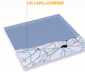 Places with similar names to Colleville-sur-Mer, France :: Disclaimer :: Information on this page comes without warranty of any kind |
||
|
Where is Colleville-sur-Mer? Elevation and coordinates ::
Latitude (lat): 49°21'0"N Longitude (lon): 0°51'0"W
Elevation (approx.): 58m (map arrows pan, magnifying glasses zoom) |
||
|
Visiting Colleville-sur-Mer? Hotel/Accommodation ::
Book a hotel in Colleville-sur-Mer Travel Guide ::
Buy a travel guide for France rental cars ::
car rental offers GPS waypoint ::
download a GPX waypoint (PoI) of Colleville-sur-Mer for your GPS receiver
|
||