|
search place name
|
||
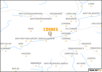
Combes (Languedoc-Roussillon, France)Combes is a town in the Languedoc-Roussillon region of France. An overview map of the region around Combes is displayed below.
regional and 3d topo map of Combes, France ::
Combes airports ::
The nearest airport is BZR - Beziers Vias, located 38.5 km south east of Combes.
Other airports nearby include DCM - Castres Mazamet (63.0 km west), MPL - Montpellier Mediterranee (72.4 km east), CCF - Carcassonne Salvaza (74.9 km south west), LBI - Albi Le Sequestre (84.3 km north west), Nearby towns ::
Lamalou-les-Bains (0.0km north) //
Le Poujol-sur-Orb (2.3km south west) //
Taussac-la-Billière (3.3km north east) //
Hérépian (4.0km east) //
Les Aires (4.4km south east) //
Le Pradal (5.5km north east) //
Saint-Gervais-sur-Mare (6.2km north west) //
Villemagne (5.7km east) //
Saint-Étienne-Estréchoux (7.5km north) //
Graissessac (7.5km north) //
Colombières (5.7km west) //
Rosis (5.7km west) //
Boussague (7.7km north east) //
Cabrerolles (9.2km south east) //
Camplong (9.2km north east) //
Saint-Geniès-de-Varensal (9.2km north west) //
[all distances 'as the bird flies' and approximate] 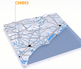 Places with similar names to Combes, France ::
Disclaimer :: Information on this page comes without warranty of any kind |
||
|
Where is Combes? Elevation and coordinates ::
Latitude (lat): 43°36'0"N Longitude (lon): 3°4'0"E
Elevation (approx.): 321m (map arrows pan, magnifying glasses zoom) |
||
|
Visiting Combes? Hotel/Accommodation ::
Book a hotel in Combes Travel Guide ::
Buy a travel guide for France rental cars ::
car rental offers GPS waypoint ::
download a GPX waypoint (PoI) of Combes for your GPS receiver
|
||