|
search place name
|
||
Cornimont (Lorraine, France)Cornimont is a town in the Lorraine region of France. An overview map of the region around Cornimont is displayed below.
regional and 3d topo map of Cornimont, France ::

Cornimont airports ::
The nearest airport is CMR - Colmar Houssen, located 42.3 km east of Cornimont.
Other airports nearby include MLH - Bale Mulhouse (67.0 km south east), EPL - Epinal Mirecourt (69.4 km north west), SXB - Strassbourg Entzheim (86.7 km north east), ENC - Nancy Essey (92.2 km north west), Nearby towns ::
Ventron (4.5km south east) //
La Bresse (5.3km north east) //
Saulxures-sur-Moselotte (5.3km west) //
Rochesson (6.7km north west) //
Le Ménil (8.3km south west) //
[all distances 'as the bird flies' and approximate] 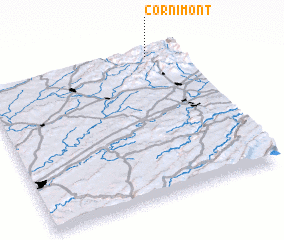 Places with similar names to Cornimont, France ::
// Greenmont (US)
// Greenmount (US)
// Greenmont (US)
// Greenmount (US)
// Greenmount (US)
// Green Mount (US)
// Cornimont (BE)
// Greenmount (AU)
// Caurnamont (AU)
// Greenmount (AU)
Disclaimer :: Information on this page comes without warranty of any kind |
||
|
Where is Cornimont? Elevation and coordinates ::
Latitude (lat): 47°58'0"N Longitude (lon): 6°50'0"E
Elevation (approx.): 534m (map arrows pan, magnifying glasses zoom) |
||
|
Visiting Cornimont? Hotel/Accommodation ::
Book a hotel in Cornimont Travel Guide ::
Buy a travel guide for France rental cars ::
car rental offers GPS waypoint ::
download a GPX waypoint (PoI) of Cornimont for your GPS receiver
|
||