|
search place name
|
||
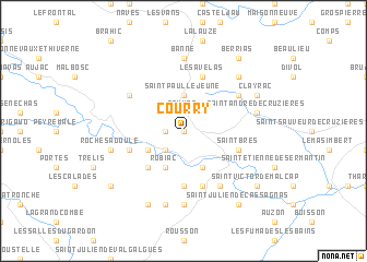
Courry (Languedoc-Roussillon, France)Courry is a town in the Languedoc-Roussillon region of France. An overview map of the region around Courry is displayed below.
regional and 3d topo map of Courry, France ::
Courry airports ::
The nearest airport is OBS - Aubenas-vals-lanas Ardeche Meridionale, located 32.4 km north east of Courry.
Other airports nearby include MEN - Mende Brenoux (54.1 km north west), FNI - Nimes Garons (64.0 km south), AVN - Avignon Caumont (74.3 km south east), MPL - Montpellier Mediterranee (81.8 km south), Nearby towns ::
Gagnières (0.0km north) //
Les Salles-de Gagnières (1.3km west) //
Sauvas (1.9km north) //
Castillon-de-Gagnières (2.3km south west) //
Foussignargues (2.3km south west) //
Saint-Paul-le-Jeune (3.7km north) //
Robiac (3.9km south) //
Meyrannes (3.9km south) //
Le Buis (3.2km south west) //
Les Brousses (4.6km south west) //
Molières-sur-Cèze (5.6km south) //
Larnac (5.7km south) //
Saint-Brès (4.4km south east) //
Bessèges (4.4km south west) //
Les Avelas (5.7km north) //
Saint-Ambroix (6.2km south east) //
Chadouillers (5.4km north east) //
Chavagnac (5.4km north west) //
Les Mages (7.4km south) //
Banne (7.4km north) //
Saint-Jean-de-Valériscle (7.5km south) //
Rochesadoule (5.6km west) //
Saint-André-de-Cruzières (5.6km east) //
La Sarrasine (6.8km north east) //
Saint-Florent-sur-Auzonnet (7.9km south) //
Clayrac (6.5km north east) //
Saint-Victor-de-Malcap (7.7km south east) //
Le Martinet (7.7km south west) //
Saint-Julien-de-Cassagnas (8.4km south east) //
[all distances 'as the bird flies' and approximate]  Places with similar names to Courry, France ::
Disclaimer :: Information on this page comes without warranty of any kind |
||
|
Where is Courry? Elevation and coordinates ::
Latitude (lat): 44°18'0"N Longitude (lon): 4°9'0"E
Elevation (approx.): 323m (map arrows pan, magnifying glasses zoom) |
||
|
Visiting Courry? Hotel/Accommodation ::
Book a hotel in Courry Travel Guide ::
Buy a travel guide for France rental cars ::
car rental offers GPS waypoint ::
download a GPX waypoint (PoI) of Courry for your GPS receiver
|
||