|
search place name
|
||
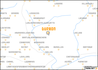
Durbon (Provence-Alpes-Côte dʼAzur, France)Durbon is a town in the Provence-Alpes-Côte dʼAzur region of France. An overview map of the region around Durbon is displayed below.
regional and 3d topo map of Durbon, France ::
Durbon airports ::
The nearest airport is VAF - Valence Chabeuil, located 69.6 km north west of Durbon.
Other airports nearby include GNB - Grenoble Saint Geoirs (87.6 km north), AVN - Avignon Caumont (105.3 km south west), OBS - Aubenas-vals-lanas Ardeche Meridionale (109.9 km west), CMF - Chambery Aix Les Bains (112.1 km north), Nearby towns ::
La Jarjatte (3.7km north) //
Beaumugne (4.5km south west) //
Saint-Julien-en-Beauchêne (4.4km south west) //
Le Villard (5.7km south) //
Agnielles (6.2km south east) //
La Rochette (6.2km south west) //
Mas Bourget (6.2km north west) //
Lus-la-Croix-Haute (5.4km north west) //
Ceilles (7.4km south) //
Les Oches (5.3km west) //
La Faurie (7.5km south) //
Montbrand (7.7km south west) //
Les Lussettes (7.7km north west) //
Les Sièzes (8.4km north west) //
La Croix Haute (9.1km north west) //
[all distances 'as the bird flies' and approximate]  Places with similar names to Durbon, France ::
Disclaimer :: Information on this page comes without warranty of any kind |
||
|
Where is Durbon? Elevation and coordinates ::
Latitude (lat): 44°38'0"N Longitude (lon): 5°45'0"E
Elevation (approx.): 1226m (map arrows pan, magnifying glasses zoom) |
||
|
Visiting Durbon? Hotel/Accommodation ::
Book a hotel in Durbon Travel Guide ::
Buy a travel guide for France rental cars ::
car rental offers GPS waypoint ::
download a GPX waypoint (PoI) of Durbon for your GPS receiver
|
||