|
search place name
|
||
Germigney (Franche-Comté, France)Germigney is a town in the Franche-Comté region of France. An overview map of the region around Germigney is displayed below.
regional and 3d topo map of Germigney, France ::

Germigney airports ::
The nearest airport is DIJ - Dijon Longvic, located 37.0 km west of Germigney.
Other airports nearby include DLE - Dole Tavaux (39.4 km south), XCD - Chalon Champforgeuil (83.2 km south west), EPL - Epinal Mirecourt (111.7 km north), XBK - Bourg Ceyzeriat (132.9 km south), Nearby towns ::
Apremont (1.9km north) //
Esmoulins (2.2km north east) //
Le Tremblois (2.5km east) //
Montseugny (3.9km south) //
Champvans (3.1km north east) //
Mantoche (3.9km north) //
Vadans (4.5km south east) //
Aubigney (5.7km south) //
La Grande-Résie (5.7km south) //
Gray-la-Ville (5.7km north) //
Velet (5.7km north) //
Chevigney (6.1km south east) //
Essertenne-et-Cecey (5.3km west) //
Broye-lès-Pesmes (7.8km south) //
Lieucourt (6.2km south east) //
Gray (7.8km north) //
Arc (7.8km north) //
La Résie-Saint-Martin (9.0km south east) //
[all distances 'as the bird flies' and approximate] 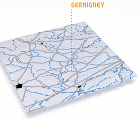 Places with similar names to Germigney, France ::
Disclaimer :: Information on this page comes without warranty of any kind |
||
|
Where is Germigney? Elevation and coordinates ::
Latitude (lat): 47°23'0"N Longitude (lon): 5°33'0"E
Elevation (approx.): 205m (map arrows pan, magnifying glasses zoom) |
||
|
Visiting Germigney? Hotel/Accommodation ::
Book a hotel in Germigney Travel Guide ::
Buy a travel guide for France rental cars ::
car rental offers GPS waypoint ::
download a GPX waypoint (PoI) of Germigney for your GPS receiver
|
||