|
search place name
|
||
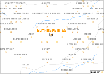
Guyans-Vennes (Franche-Comté, France)Guyans-Vennes is a town in the Franche-Comté region of France. An overview map of the region around Guyans-Vennes is displayed below.
regional and 3d topo map of Guyans-Vennes, France ::
Guyans-Vennes airports ::
The nearest airport is BRN - Bern Belp, located 75.4 km east of Guyans-Vennes.
Other airports nearby include DLE - Dole Tavaux (87.4 km west), MLH - Bale Mulhouse (87.6 km north east), GVA - Geneva Cointrin (107.2 km south), QNJ - Annemasse (108.9 km south), Nearby towns ::
Fuans (2.2km south east) //
Grandfontaine-Fournets (2.2km south west) //
Consolation-Maisonnettes (2.5km east) //
Plaimbois-Vennes (3.9km north) //
Orchamps-Vennes (3.1km south west) //
Luisans (5.7km south) //
Laval-le-Prieuré (5.3km north east) //
La Sommette (5.3km north west) //
Loray (5.0km west) //
Mont-de-Laval (5.4km east) //
Pierrefontaine-les-Varans (7.5km north) //
Le Bélieu (6.3km south east) //
Les Fins (9.0km south east) //
Bretonvillers (9.0km north east) //
[all distances 'as the bird flies' and approximate] 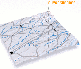 Places with similar names to Guyans-Vennes, France :: Disclaimer :: Information on this page comes without warranty of any kind |
||
|
Where is Guyans-Vennes? Elevation and coordinates ::
Latitude (lat): 47°9'0"N Longitude (lon): 6°34'0"E
Elevation (approx.): 778m (map arrows pan, magnifying glasses zoom) |
||
|
Visiting Guyans-Vennes? Hotel/Accommodation ::
Book a hotel in Guyans-Vennes Travel Guide ::
Buy a travel guide for France rental cars ::
car rental offers GPS waypoint ::
download a GPX waypoint (PoI) of Guyans-Vennes for your GPS receiver
|
||