|
search place name
|
||
Jandun (Champagne-Ardenne, France)Jandun is a town in the Champagne-Ardenne region of France. An overview map of the region around Jandun is displayed below.
regional and 3d topo map of Jandun, France ::

Jandun airports ::
The nearest airport is RHE - Reims Champagne, located 52.4 km south west of Jandun.
Other airports nearby include CRL - Charleroi Brussels South (90.3 km north), LUX - Luxemburg Luxembourg (120.0 km east), LGG - Liege (127.0 km north east), MZM - Metz Frescaty (131.7 km south east), Nearby towns ::
Launois-sur-Vence (1.2km west) //
Barbaise (2.2km north east) //
Neuvizy (2.2km south west) //
Villers-le-Tourneur (2.2km south east) //
Raillicourt (2.4km east) //
Hagnicourt (3.9km south) //
Puiseux (5.7km south) //
Viel-Saint-Rémy (4.0km south west) //
Faissault (5.2km south west) //
Montigny-sur-Vence (4.8km east) //
Wignicourt (7.5km south) //
Hocmont (5.1km east) //
Gruyères (8.2km north east) //
Thin-le-Moutier (8.2km north west) //
Saint-Loup-Terrier (8.8km south east) //
Saulces-Monclin (8.8km south west) //
[all distances 'as the bird flies' and approximate] 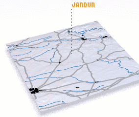 Places with similar names to Jandun, France ::
// Ginot-an (PH)
// Genėtiniai (LT)
// Genėtiniai (LT)
// Ginteniai (LT)
// John Town (US)
// Genntown (US)
// Johntown (US)
// Johntown (US)
// Gentan (ID)
// Gentan (ID)
Disclaimer :: Information on this page comes without warranty of any kind |
||
|
Where is Jandun? Elevation and coordinates ::
Latitude (lat): 49°39'0"N Longitude (lon): 4°33'0"E
Elevation (approx.): 197m (map arrows pan, magnifying glasses zoom) |
||
|
Visiting Jandun? Hotel/Accommodation ::
Book a hotel in Jandun Travel Guide ::
Buy a travel guide for France rental cars ::
car rental offers GPS waypoint ::
download a GPX waypoint (PoI) of Jandun for your GPS receiver
|
||