|
search place name
|
||
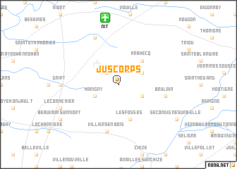
Juscorps (Poitou-Charentes, France)Juscorps is a town in the Poitou-Charentes region of France. An overview map of the region around Juscorps is displayed below.
regional and 3d topo map of Juscorps, France ::
Juscorps airports ::
The nearest airport is NIT - Niort Souche, located 10.6 km north of Juscorps.
Other airports nearby include RCO - Rochefort St Agnant (59.1 km south west), CNG - Cognac Chateaubernard (62.3 km south), PIS - Poitiers Biard (67.2 km north east), ANG - Angouleme Brie Champniers (71.6 km south east), Nearby towns ::
Fors (2.3km north west) //
Saint-Martin-de-Bernegoue (3.2km north east) //
Saint-Romans-des-Champs (3.2km south east) //
Marigny (3.2km south west) //
Prahecq (4.5km north east) //
Les Fosses (5.7km south) //
Brûlain (5.5km east) //
Villiers-en-Bois (7.5km south) //
Aiffres (7.8km north) //
[all distances 'as the bird flies' and approximate] 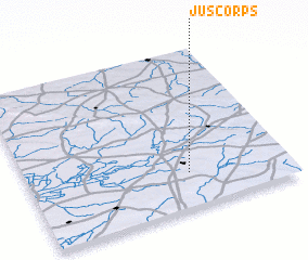 Places with similar names to Juscorps, France :: Disclaimer :: Information on this page comes without warranty of any kind |
||
|
Where is Juscorps? Elevation and coordinates ::
Latitude (lat): 46°13'0"N Longitude (lon): 0°23'0"W
Elevation (approx.): 48m (map arrows pan, magnifying glasses zoom) |
||
|
Visiting Juscorps? Hotel/Accommodation ::
Book a hotel in Juscorps Travel Guide ::
Buy a travel guide for France rental cars ::
car rental offers GPS waypoint ::
download a GPX waypoint (PoI) of Juscorps for your GPS receiver
|
||