|
search place name
|
||
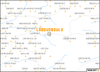
La Bourboule (Auvergne, France)La Bourboule is a town in the Auvergne region of France. An overview map of the region around La Bourboule is displayed below.
regional and 3d topo map of La Bourboule, France ::
La Bourboule airports ::
The nearest airport is CFE - Clermont Ferrand Auvergne, located 39.7 km north east of La Bourboule.
Other airports nearby include MCU - Montlucon-gueret Montlucon Gueret (77.1 km north west), AUR - Aurillac (81.1 km south), VHY - Vichy Charmeil (82.6 km north east), MCU - Montlucon Domerat (86.6 km north), Nearby towns ::
Murat-le-Quaire (2.3km north west) //
Chez Rigaud (4.5km north west) //
Liournat (3.9km west) //
Lestomble (5.7km north) //
Le Clou (5.7km south) //
Férérolles (5.4km south west) //
Hors (5.4km north west) //
Chastreix (7.4km south) //
Le Mont-Dore (5.5km east) //
La Chaleille (5.5km west) //
Laqueuille (7.5km north) //
Saint-Sauves- dʼAuvergne (5.5km west) //
Choriol (5.5km west) //
La Goulandre (6.8km north west) //
La Tour-dʼAuvergne (6.8km south west) //
Machazeix (7.9km south) //
La Gratade (9.0km north east) //
[all distances 'as the bird flies' and approximate] 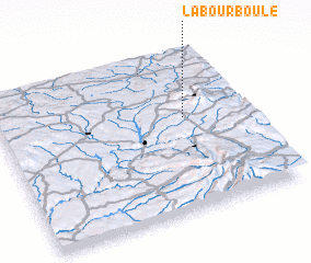 Places with similar names to La Bourboule, France ::
Disclaimer :: Information on this page comes without warranty of any kind |
||
|
Where is La Bourboule? Elevation and coordinates ::
Latitude (lat): 45°35'0"N Longitude (lon): 2°45'0"E
Elevation (approx.): 1028m (map arrows pan, magnifying glasses zoom) |
||
|
Visiting La Bourboule? Hotel/Accommodation ::
Book a hotel in La Bourboule Travel Guide ::
Buy a travel guide for France rental cars ::
car rental offers GPS waypoint ::
download a GPX waypoint (PoI) of La Bourboule for your GPS receiver
|
||