|
search place name
|
||
La Bretonnière (Bretagne, France)La Bretonnière is a town in the Bretagne region of France. An overview map of the region around La Bretonnière is displayed below.
regional and 3d topo map of La Bretonnière, France ::

La Bretonnière airports ::
The nearest airport is RNS - Rennes St Jacques, located 37.7 km north west of La Bretonnière.
Other airports nearby include LVA - Laval Entrammes (42.3 km east), NTE - Nantes Atlantique (88.4 km south), SNR - St.-nazaire Montoir (93.6 km south west), DNR - Dinard Pleurtuit (95.2 km north west), Nearby towns ::
Tincé (2.2km north east) //
Moussé (2.2km north east) //
Arbrissel (2.2km north west) //
Drouges (2.2km south east) //
La Tonnevraie (3.1km south east) //
LʼOnglée (3.9km north) //
Visseiche (3.9km north) //
Rannée (3.7km east) //
Forges-la-Forêt (5.7km south) //
La Guerche-de-Bretagne (4.2km north east) //
La Cornouaille (5.7km north) //
Étanchet (5.7km north) //
La Rousselière (4.2km south east) //
La Foucherie (6.1km south west) //
Moutiers (7.5km north east) //
Le Boulay (7.5km south west) //
La Girière (8.3km south west) //
La Geslinière (8.9km north east) //
Chelun (8.9km south east) //
[all distances 'as the bird flies' and approximate] 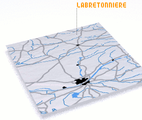 Places with similar names to La Bretonnière, France ::
// La Bretonnière (FR)
// La Bretenière (FR)
// La Bretenière (FR)
// La Bourdinière (FR)
// La Bertinerie (FR)
// La Bourdinière (FR)
// La Bourdinière (FR)
// La Bourdinière (FR)
// La Bourdinière (FR)
// La Bourdinière (FR)
Disclaimer :: Information on this page comes without warranty of any kind |
||
|
Where is La Bretonnière? Elevation and coordinates ::
Latitude (lat): 47°55'0"N Longitude (lon): 1°17'0"W
Elevation (approx.): 77m (map arrows pan, magnifying glasses zoom) |
||
|
Visiting La Bretonnière? Hotel/Accommodation ::
Book a hotel in La Bretonnière Travel Guide ::
Buy a travel guide for France rental cars ::
car rental offers GPS waypoint ::
download a GPX waypoint (PoI) of La Bretonnière for your GPS receiver
|
||