|
search place name
|
||
Lamaronde (Picardie, France)Lamaronde is a town in the Picardie region of France. An overview map of the region around Lamaronde is displayed below.
regional and 3d topo map of Lamaronde, France ::

Lamaronde airports ::
The nearest airport is BVA - Beauvais Tille, located 41.4 km south of Lamaronde.
Other airports nearby include URO - Rouen Vallee De Seine (69.9 km south west), CSF - Creil (75.5 km south east), POX - Pontoise Cormeilles En Vexin (78.9 km south), LTQ - Le Tourquet Le Touquet Paris Plage (82.3 km north), Nearby towns ::
Caulières (1.9km south) //
Bettembos (1.2km west) //
Boulainvillers (2.2km north west) //
Meigneux (3.9km south) //
Thieulloy-lʼAbbaye (3.0km north east) //
Vraignes-lès-Hornoy (3.9km north) //
Lignières-Châtelain (4.4km south west) //
Tronchoy (4.4km north west) //
Souplicourt (5.6km south) //
Offignies (3.6km west) //
Orival (3.6km west) //
Hornoy (5.6km north) //
Sainte-Segrée (5.7km south) //
Éplessier (4.0km south east) //
Boisrault (5.7km north) //
Marlers (5.2km south west) //
Lachapelle-sur-Poix (5.2km south east) //
Saulchoy-sous-Poix (6.1km south east) //
Frettemolle (6.1km south west) //
Thieulloy-la-Ville (6.1km south east) //
Gouy-lʼHôpital (5.2km north east) //
Selincourt (7.4km north) //
Morvillers-Saint-Saturnin (5.1km west) //
Hescamps-Saint-Clair (7.5km south) //
Belloy-Saint-Léonard (7.5km south) //
Méréaucourt (7.5km south) //
Le Rozel (5.1km west) //
Bézencourt (6.6km north west) //
Guibermesnil (6.6km north west) //
[all distances 'as the bird flies' and approximate] 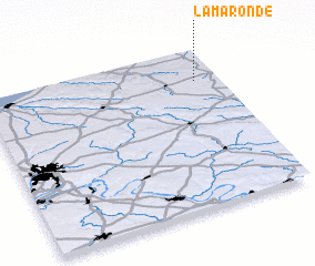 Places with similar names to Lamaronde, France ::
// Lo Miranda (CL)
// La Miranda (CO)
// La Miranda (CO)
// La Miranda (CO)
// La Miranda (CO)
// La Miranda (CO)
// La Morenita (GT)
// Lamorende (ID)
// La Mirande (GF)
// Lamorountoa (VU)
Disclaimer :: Information on this page comes without warranty of any kind |
||
|
Where is Lamaronde? Elevation and coordinates ::
Latitude (lat): 49°48'0"N Longitude (lon): 1°54'0"E
Elevation (approx.): 181m (map arrows pan, magnifying glasses zoom) |
||
|
Visiting Lamaronde? Hotel/Accommodation ::
Book a hotel in Lamaronde Travel Guide ::
Buy a travel guide for France rental cars ::
car rental offers GPS waypoint ::
download a GPX waypoint (PoI) of Lamaronde for your GPS receiver
|
||