|
search place name
|
||
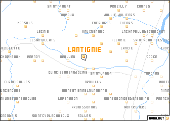
Lantignié (Rhône-Alpes, France)Lantignié is a town in the Rhône-Alpes region of France. An overview map of the region around Lantignié is displayed below.
regional and 3d topo map of Lantignié, France ::
Lantignié airports ::
The nearest airport is QNX - Macon Charnay, located 20.4 km north east of Lantignié.
Other airports nearby include XVF - Vilefrance Tarare (27.6 km south), RNE - Roanne Renaison (49.9 km west), XBK - Bourg Ceyzeriat (51.2 km east), LYN - Lyon Bron (52.8 km south east), Nearby towns ::
Durette (1.9km south) //
Régnié (2.3km south east) //
Beaujeu (2.6km west) //
Quincié-en-Beaujolais (4.5km south west) //
Cercié (4.5km south east) //
Saint-Lager (4.5km south east) //
Chiroubles (4.5km north east) //
Avenas (5.7km north) //
Brouilly (5.7km south) //
Villié-Morgon (4.3km north east) //
Vauxrenard (5.7km north) //
Marchampt (5.3km south west) //
Saint-Étienne-la-Varenne (7.4km south) //
Odenas (7.5km south) //
Fleurie (6.3km north east) //
Émeringes (7.8km north) //
Charentay (8.4km south east) //
[all distances 'as the bird flies' and approximate] 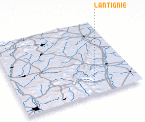 Places with similar names to Lantignié, France ::
// Landakan (PH)
// Landican (PH)
// Lindogon (PH)
// Lantagon (BJ)
// Lantiquín (GT)
// Lentigny (FR)
// Londigny (FR)
// Lindicun (CN)
// Llandecwyn (GB)
// Lin-te-kuan (TW)
Disclaimer :: Information on this page comes without warranty of any kind |
||
|
Where is Lantignié? Elevation and coordinates ::
Latitude (lat): 46°9'0"N Longitude (lon): 4°38'0"E
Elevation (approx.): 355m (map arrows pan, magnifying glasses zoom) |
||
|
Visiting Lantignié? Hotel/Accommodation ::
Book a hotel in Lantignié Travel Guide ::
Buy a travel guide for France rental cars ::
car rental offers GPS waypoint ::
download a GPX waypoint (PoI) of Lantignié for your GPS receiver
|
||